Area Overview for OX10 8EG
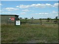
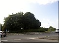
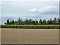
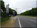
Photos of OX10 8EG


Area Information
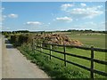
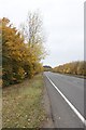
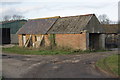
Living in OX10 8EG offers a country experience defined by a small residential cluster within a rural postcode area in England. The land spans 1160 m² and holds a population of just 1026 people. This creates a low-density environment with a population density of 476 people per square kilometre. You find yourself in a setting where space is at a premium, yet the community remains tightly knit. The area is home to predominantly white residents seeking a quiet retreat away from urban congestion. Daily life here revolves around local habitation rather than distant city centres. The housing stock consists almost entirely of houses, reinforcing the character of a traditional village settlement. This specific postcode serves as a gateway to wider countryside living without the chaos of major towns. Residents here enjoy the tranquility of open spaces while maintaining access to essential services within a reasonable drive.
- Area Type
- Postcode
- Area Size
- 1160 m²
- Population
- 1026
- Population Density
- 476 people/km²
The property market in OX10 8EG is dominated by owner-occupiers due to the high percentage of homeownership at 79%. This figure signals that investment buyers are rare and the market consists largely of long-term residents. The accommodation type is strictly houses, confirming that this postcode does not offer flats, penthouses, or new-build apartments. This exclusivity appeals to families or individuals who require standalone living spaces with private grounds. A rental market exists only on a very limited scale, as most properties are permanently occupied by their owners. Buying a home here means joining an established community where property values have historically remained stable given the low turnover. The small area size of 1160 m² further constrains large-scale development projects. Prospective buyers focusing on this specific location should prepare for competition among local residents rather than external investors. The character of the neighbourhood is preserved because new builds rarely replace established stock in such a compact rural cluster.
House Prices in OX10 8EG
Showing 1 properties
| Address | Type | Beds | Baths | Last Sale Price | Last Sale Date | |
|---|---|---|---|---|---|---|
| Fernleigh, 135 The Street, Crowmarsh Gifford, Wallingford, OX10 8EG | Detached | - | - | - | - |
Energy Efficiency in OX10 8EG
Daily life for residents of OX10 8EG is enhanced by a range of amenities within practical reach. On the retail front, there are five notable options including Waitrose Wallingford, Asda Rectory, and Lidl Lupton Road. These supermarkets cater to various grocery needs from budget shopping to premium selection. For rail travel, three stations offer connectivity: Cholsey Railway Station, Goring and Streatley Railway Station, and Didcot Parkway Railway Station. Two airports are accessible nearby, specifically RAF Benson and Chalgrove Airport, though their utility varies for personal travel. One metro location, Wallingford, serves as a local transport hub for day-to-day movement. This mix of retail, rail, and airport access reduces the need for long-distance driving for essential trips. The presence of Asda and Lidl ensures that cost-conscious shoppers can find affordable goods without traveling far. Waitrose provides a choice for those seeking higher-end provisions. You can manage most daily tasks locally while retaining the option to travel further by train or road when necessary.
Amenities
Schools
Families considering homes in OX10 8EG will find one primary option immediately accessible: Crowmarsh Gifford Church of Education School. This institution holds a Good rating from Ofsted, reflecting its consistent educational standards. The school serves as the principal educational hub for the immediate neighbourhood. Because the area is small and rural, secondary education options are not listed within the provided data for this specific postcode. Parents often rely on this primary school before transferring children to institutions in nearby larger towns or villages. The availability of a single primary school with a positive rating provides a reliable foundation for early education. Travel times to secondary schools are not specified in the available information, but the presence of a good-rated primary school indicates a functional local education system. You should verify travel distances and catchment boundaries if secondary education becomes a priority during your move to this location.
| Rank | School | Type | Entry gender | Ages |
|---|
Explore more schools in this area
Go to Schools tabDemographics
The community in OX10 8EG is mature and established. The median age stands at 47 years, placing it well above the national average. Adults aged between 30 and 64 years represent the most common age range within the population. This demographic skews older than typical commuter zones, suggesting a stable resident base rather than a transient workforce. Home ownership is exceptionally high, with 79% of residents owning their homes outright. This level of tenure indicates strong economic standing among local inhabitants and a rejection of the rental market. The predominant ethnic group is White, matching the broader national composition. Accommodation types are exclusively houses, meaning you will not find flats or apartments in this immediate cluster. The area lacks data on deprivation scores, but the high ownership rate often correlates with financial stability. This demographic profile attracts families who have settled down or retirees looking for a permanent rural base.
Household Size
Accommodation Type
Tenure
Ethnic Group
Religion
Household Composition
Age
Household Deprivation
NS-SEC
Explore more demographic insights in this area
Go to Demographics tabPlanning
Planning Constraints
- Flood RiskPremium
- Ramsar Wetland SitesPremium
- Area of Outstanding Natural BeautyPremium
- Protected Nature ReservePremium
- Protected WoodlandPremium