Area Overview for OX10 8BQ
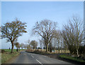
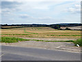
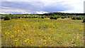
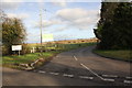
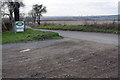
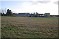
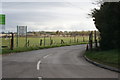
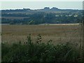
Photos of OX10 8BQ


Area Information
Living in OX10 8BQ means residing within a compact residential cluster that spans 1.2 square kilometres. This specific postcode area accommodates a population of 2,069 people, resulting in a density of 61 people per square kilometre. The location offers a quiet, contained environment where daily life revolves around stable, established neighbourhoods rather than sprawling urban centres. Prospective buyers looking for homes in OX10 8BQ will find a setting defined by its small scale and focused community atmosphere. The area sits quietly away from the busiest traffic arteries, providing a calm backdrop for domestic routines. Residents here experience a lifestyle characterised by close proximity to essential services without the noise of a dense city centre. The physical boundaries are clear, creating a distinct enclave where the pace of life remains unhurried. This postcode represents a specific type of residential opportunity for those who prioritise space and tranquility over high-density living. The character of the area is shaped largely by its limited size and the stable demographic profile that has settled within these confines. Understanding the compact nature of OX10 8BQ is essential for anyone considering moving here, as the layout dictates how easily one can access local facilities. The environment is practical and straightforward, offering a functional base from which to explore the wider region.
- Area Type
- Postcode
- Area Size
- 1.2 km²
- Population
- 2069
- Population Density
- 61 people/km²
The property market in OX10 8BQ is defined by a stock consisting primarily of houses. This accommodation type aligns with the area's status as a residential cluster where detached and semi-detached homes are the standard. Findings regarding the property market in this specific postcode show that 67% of households are owner-occupied. This significant majority indicates that the area functions as a long-term home base rather than a transient rental market. Buyers viewing homes in OX10 8BQ will encounter a market driven by homeowners looking to maintain their residences or move their family within the area. The high level of ownership suggests stability and lower short-term turnover compared to student or rental hotspots. Houses dominate the landscape, meaning you are unlikely to find purpose-built flats or high-rise apartments here. The nature of the housing stock supports a quiet lifestyle suited to families or mature couples. This market dynamic means prices often reflect the cost of living on one's own property rather than paying rent. Understanding that over two-thirds of residents own their homes helps contextualise the pace of any local development. The property profile is consistent with the demographic data, showing a strong link between housing tenure and the age of the resident population.
House Prices in OX10 8BQ
Showing 3 properties
| Address | Type | Beds | Baths | Last Sale Price | Last Sale Date | |
|---|---|---|---|---|---|---|
| 2, Coldharbour Farm Cottages, Crowmarsh Hill, Crowmarsh Gifford, Wallingford, OX10 8BQ | Semi-detached | - | - | - | - | |
| Coldharbour Farm, Crowmarsh Hill, Crowmarsh Gifford, Wallingford, OX10 8BQ | house | - | - | - | - | |
| 1, Coldharbour Farm Cottages, Crowmarsh Hill, Crowmarsh Gifford, Wallingford, OX10 8BQ | house | - | - | - | - |
Energy Efficiency in OX10 8BQ
Residents of OX10 8BQ benefit from practical amenities located within easy reach of their homes. There are two airports in the broader vicinity, with RAF Benson and Chalgrove Airport being the notable locations. Five retail outlets serve the local community, including Waitrose Wallingford, Asda Rectory, and Co-op Benson. These specific venues provide for everyday shopping needs from groceries to household essentials. Travel connections are facilitated by nearby rail stations at Goring and Streatley Railway Station and Cholsey Railway Station. These stations allow access to larger transport hubs beyond the small residential cluster. The metro connection at Wallingford also provides another option for commuters exploring the region. This combination of five retail sites and multiple transport nodes ensures convenience for those living in OX10 8BQ. Daily life involves short trips to these established local stores rather than long journeys to city centres. The presence of Waitrose Wallingford and Asda Rectory guarantees access to quality food and general merchandise. For those considering homes in OX10 8BQ, the proximity of these named amenities reduces reliance on cars for routine errands. The transport links, including the nearby airport options, also add value for business travellers or aviation enthusiasts in the area.
Amenities
Schools
Families living in OX10 8BQ have access to two independent schools within the immediate vicinity. Carmel College is one of the available options for children in the area. Turners Court School is the second independent institution nearby. Both schools operate as private institutions, offering an alternative to the state school system for local families. The presence of these two independent schools suggests a local community that values private education or has specific faith-based requirements. This mix of school types provides variety for parents deciding where to send their children, though the options are limited to private provision in this specific size of area. Living in OX10 8BQ places you close to both Carlton College and Turners Court School, ensuring short travel distances for school runs. The concentration of independent schools in such a small 1.2 square kilometre area indicates a specialised educational catchment or commute pattern. Prospective homebuyers must consider the location of these specific institutions against their preferred education choices. There are no state-maintained schools listed in the nearest proximity to this postcode. The availability of these two specific independent schools shapes the educational landscape for the 2,069 people who call this area home.
| Rank | School | Type | Entry gender | Ages |
|---|
Explore more schools in this area
Go to Schools tabDemographics
The community within OX10 8BQ is dominated by adults aged between 30 and 64 years. This age group forms the most common demographic range for residents in the area. The median age for the population is 47 years old, indicating a mature household structure. Home ownership is prevalent, with 67% of households belonging to owner-occupiers. This high ownership rate suggests a stable community where long-term residents form the majority of the neighbourhood. Houses make up the predominant accommodation type, reflecting a preference for detached or multi-dwelling properties over flats or shared housing. The predominant ethnic group in the area is White, representing the majority of the local population. With an area size of 1.2 square kilometres and a total population of 2,069, the social fabric is tight-knit and familiar to long-term residents. Living in OX10 8BQ offers a sense of continuity, as the low turnover of residents allows for established local networks. The demographic profile points towards families and empty-nesters rather than young singles or students. This stability contributes to a predictable environment where neighbours know one another personally. The age distribution and home ownership levels provide clear indicators of the area's character as a family-oriented, settled residential zone.
Household Size
Accommodation Type
Tenure
Ethnic Group
Religion
Household Composition
Age
Household Deprivation
NS-SEC
Explore more demographic insights in this area
Go to Demographics tabPlanning
Planning Constraints
- Flood RiskPremium
- Ramsar Wetland SitesPremium
- Area of Outstanding Natural BeautyPremium
- Protected Nature ReservePremium
- Protected WoodlandPremium