Area Overview for OX10 7JX
Photos of OX10 7JX
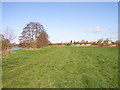
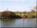
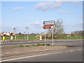
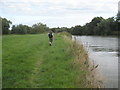
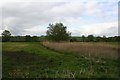
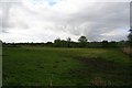
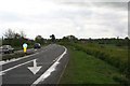
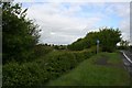
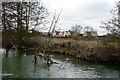
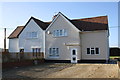
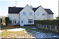
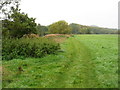
70 photos from this area
Area Information
Key information about the OX10 7JX including its size, population, and administrative classification.
- Area Type
- Postcode
- Area Size
- 31.9 hectares
- Population
- 1679
- Population Density
- 170 people/km²
House Prices in OX10 7JX
20
Properties
£443,211
Average Sold Price
£200,000
Lowest Price
£830,000
Highest Price
Showing 20 properties
| Address | Type | Beds | Baths | Last Sale Price | Last Sale Date | |
|---|---|---|---|---|---|---|
| 5 Meadside, Dorchester On Thames, Wallingford, OX10 7JX | Semi-detached | 3 | 1 | £500,000 | Jan 2025 | |
| 12 Meadside, Dorchester On Thames, Wallingford, OX10 7JX | Semi-detached | 4 | 2 | £725,000 | Aug 2023 | |
| 6 Meadside, Dorchester On Thames, Wallingford, OX10 7JX | Semi-detached | 5 | 2 | £830,000 | Jan 2023 | |
| 3 Meadside, Dorchester On Thames, Wallingford, OX10 7JX | Semi-detached | 3 | 1 | £545,000 | Mar 2021 | |
| 4 Meadside, Dorchester On Thames, Wallingford, OX10 7JX | house | 3 | - | £365,000 | Nov 2013 | |
| 17 Meadside, Dorchester On Thames, Wallingford, OX10 7JX | Semi-detached | - | - | £325,000 | Nov 2006 | |
| 1 Meadside, Dorchester On Thames, Wallingford, OX10 7JX | Semi-detached | - | - | £249,900 | Dec 2003 | |
| 15 Meadside, Dorchester On Thames, Wallingford, OX10 7JX | house | 4 | - | £249,000 | Jun 2002 | |
| 13 Meadside, Dorchester On Thames, Wallingford, OX10 7JX | Semi-detached | - | - | £200,000 | Sep 2000 | |
| 11 Meadside, Dorchester On Thames, Wallingford, OX10 7JX | Semi-detached | - | - | - | - |
Page 1 of 2
Energy Efficiency in OX10 7JX
Amenities
Schools
| Rank | School | Type | Entry gender | Ages |
|---|
Explore more schools in this area
Go to Schools tabDemographics
Household Size
Two person
most common
Accommodation Type
Houses
most common
Tenure
79
majority
Ethnic Group
White
most common
Religion
N/A
most common
Household Composition
N/A
most common
Age
47
median
Adults (30-64 years)
most common
Household Deprivation
N/A
with no deprivation
NS-SEC
53
in Lower managerial occupations
Explore more demographic insights in this area
Go to Demographics tabPlanning
Planning Constraints
- Flood RiskPremium
- Ramsar Wetland SitesPremium
- Area of Outstanding Natural BeautyPremium
- Protected Nature ReservePremium
- Protected WoodlandPremium