Area Overview for OX1 2JL
Photos of OX1 2JL

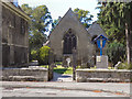
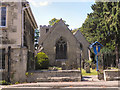
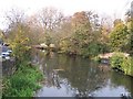
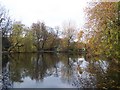
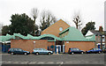
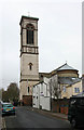
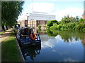
100 photos from this area
Area Information
Key information about the OX1 2JL including its size, population, and administrative classification.
- Area Type
- Postcode
- Area Size
- 2.6 hectares
- Population
- 1692
- Population Density
- 2540 people/km²
House Prices in OX1 2JL
15
Properties
£576,193
Average Sold Price
£42,000
Lowest Price
£1,100,000
Highest Price
Showing 15 properties
| Address | Type | Beds | Baths | Last Sale Price | Last Sale Date | |
|---|---|---|---|---|---|---|
| 27A Richmond Road, Oxford, OX1 2JL | Flat | - | - | £350,000 | Jan 2013 | |
| 28 Richmond Road, Oxford, OX1 2JL | Semi-detached | 4 | 3 | £1,100,000 | Oct 2009 | |
| 24 Richmond Road, Oxford, OX1 2JL | house | - | - | £591,350 | Oct 2006 | |
| 16 Richmond Road, Oxford, OX1 2JL | Semi-detached | 4 | 2 | £650,000 | Mar 2006 | |
| 17 Richmond Road, Oxford, OX1 2JL | studentAccommodation | - | - | £650,000 | May 2005 | |
| 15 Richmond Road, Oxford, OX1 2JL | Semi-detached | - | - | £650,000 | May 2004 | |
| 26 Richmond Road, Oxford, OX1 2JL | Semi-detached | - | - | £42,000 | Jun 1997 | |
| Top Flat, 29 Richmond Road, Oxford, OX1 2JL | Semi-detached | 4 | 3 | - | - | |
| 25 Richmond Road, Oxford, OX1 2JL | Terraced | - | - | - | - | |
| 19 Richmond Road, Oxford, OX1 2JL | studentAccommodation | - | - | - | - |
Page 1 of 2
Energy Efficiency in OX1 2JL
Amenities
Schools
| Rank | School | Type | Entry gender | Ages |
|---|
Explore more schools in this area
Go to Schools tabDemographics
Household Size
Two person
most common
Accommodation Type
Houses
most common
Tenure
34
majority
Ethnic Group
White
most common
Religion
N/A
most common
Household Composition
N/A
most common
Age
22
median
Young Adults (15-29 years)
most common
Household Deprivation
N/A
with no deprivation
NS-SEC
32
in Lower managerial occupations
Explore more demographic insights in this area
Go to Demographics tabPlanning
Planning Constraints
- Flood RiskPremium
- Ramsar Wetland SitesPremium
- Area of Outstanding Natural BeautyPremium
- Protected Nature ReservePremium
- Protected WoodlandPremium