Area Overview for MK8 0NP
Photos of MK8 0NP
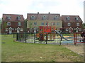
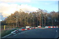
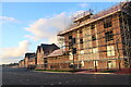
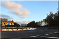

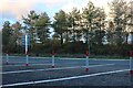
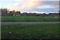
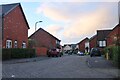
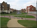
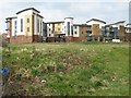
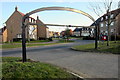
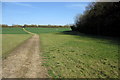
19 photos from this area
Area Information
Key information about the MK8 0NP including its size, population, and administrative classification.
- Area Type
- Postcode
- Area Size
- 6387 m²
- Population
- 2095
- Population Density
- 3876 people/km²
House Prices in MK8 0NP
18
Properties
£310,694
Average Sold Price
£175,000
Lowest Price
£590,000
Highest Price
Showing 18 properties
| Address | Type | Beds | Baths | Last Sale Price | Last Sale Date | |
|---|---|---|---|---|---|---|
| 39 Wickstead Avenue, Grange Farm, Milton Keynes, MK8 0NP | Terraced | 4 | 2 | £352,500 | Mar 2024 | |
| 19 Wickstead Avenue, Grange Farm, Milton Keynes, MK8 0NP | house | 4 | 3 | £300,000 | Nov 2023 | |
| 17 Wickstead Avenue, Grange Farm, Milton Keynes, MK8 0NP | Semi-detached | 4 | 2 | £345,000 | Aug 2021 | |
| 9 Wickstead Avenue, Grange Farm, Milton Keynes, MK8 0NP | house | 5 | - | £590,000 | Feb 2021 | |
| 21 Wickstead Avenue, Grange Farm, Milton Keynes, MK8 0NP | Terraced | 4 | 3 | £295,000 | May 2019 | |
| 41 Wickstead Avenue, Grange Farm, Milton Keynes, MK8 0NP | Terraced | 4 | 2 | £325,000 | Oct 2017 | |
| 27 Wickstead Avenue, Grange Farm, Milton Keynes, MK8 0NP | Semi-detached | 4 | 3 | £290,000 | Dec 2016 | |
| 33 Wickstead Avenue, Grange Farm, Milton Keynes, MK8 0NP | Terraced | 4 | 1 | £280,000 | Oct 2015 | |
| 25 Wickstead Avenue, Grange Farm, Milton Keynes, MK8 0NP | Semi-detached | 4 | 3 | £220,000 | Nov 2010 | |
| 11 Wickstead Avenue, Grange Farm, Milton Keynes, MK8 0NP | house | 3 | - | £230,000 | May 2010 |
Page 1 of 2
Energy Efficiency in MK8 0NP
Amenities
Schools
| Rank | School | Type | Entry gender | Ages |
|---|
Explore more schools in this area
Go to Schools tabDemographics
Household Size
Family (3-5 people)
most common
Accommodation Type
Houses
most common
Tenure
65
majority
Ethnic Group
White
most common
Religion
N/A
most common
Household Composition
N/A
most common
Age
47
median
Adults (30-64 years)
most common
Household Deprivation
N/A
with no deprivation
NS-SEC
42
in Lower managerial occupations
Explore more demographic insights in this area
Go to Demographics tabPlanning
Planning Constraints
- Flood RiskPremium
- Ramsar Wetland SitesPremium
- Area of Outstanding Natural BeautyPremium
- Protected Nature ReservePremium
- Protected WoodlandPremium