Area Overview for MK7 7SW
Photos of MK7 7SW
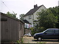

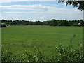
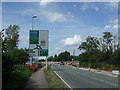
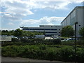


22 photos from this area
Area Information
Key information about the MK7 7SW including its size, population, and administrative classification.
- Area Type
- Postcode
- Area Size
- 3495 m²
- Population
- 1559
- Population Density
- 3249 people/km²
House Prices in MK7 7SW
16
Properties
£157,332
Average Sold Price
£64,990
Lowest Price
£260,000
Highest Price
Showing 16 properties
| Address | Type | Beds | Baths | Last Sale Price | Last Sale Date | |
|---|---|---|---|---|---|---|
| 50 Coggeshall Grove, Wavendon Gate, Milton Keynes, MK7 7SW | Terraced | 2 | 1 | £260,000 | Aug 2021 | |
| 53 Coggeshall Grove, Wavendon Gate, Milton Keynes, MK7 7SW | Semi-detached | 2 | 1 | £230,000 | Nov 2018 | |
| 52 Coggeshall Grove, Wavendon Gate, Milton Keynes, MK7 7SW | Terraced | - | - | £139,000 | Nov 2005 | |
| 51 Coggeshall Grove, Wavendon Gate, Milton Keynes, MK7 7SW | Terraced | 2 | - | £124,000 | Mar 2003 | |
| 47 Coggeshall Grove, Wavendon Gate, Milton Keynes, MK7 7SW | Semi-detached | 2 | 1 | £126,000 | Jan 2003 | |
| 49 Coggeshall Grove, Wavendon Gate, Milton Keynes, MK7 7SW | house | 2 | - | £64,990 | Mar 1999 | |
| 46 Coggeshall Grove, Wavendon Gate, Milton Keynes, MK7 7SW | house | - | - | - | - | |
| 54 Coggeshall Grove, Wavendon Gate, Milton Keynes, MK7 7SW | Terraced | - | - | - | - | |
| 43 Coggeshall Grove, Wavendon Gate, Milton Keynes, MK7 7SW | Terraced | - | - | - | - | |
| 40 Coggeshall Grove, Wavendon Gate, Milton Keynes, MK7 7SW | house | - | - | - | - |
Page 1 of 2
Energy Efficiency in MK7 7SW
Amenities
Schools
| Rank | School | Type | Entry gender | Ages |
|---|
Explore more schools in this area
Go to Schools tabDemographics
Household Size
Family (3-5 people)
most common
Accommodation Type
Houses
most common
Tenure
36
majority
Ethnic Group
White
most common
Religion
N/A
most common
Household Composition
N/A
most common
Age
47
median
Adults (30-64 years)
most common
Household Deprivation
N/A
with no deprivation
NS-SEC
28
in Lower managerial occupations
Explore more demographic insights in this area
Go to Demographics tabPlanning
Planning Constraints
- Flood RiskPremium
- Ramsar Wetland SitesPremium
- Area of Outstanding Natural BeautyPremium
- Protected Nature ReservePremium
- Protected WoodlandPremium