Area Overview for MK7 7SL
Photos of MK7 7SL
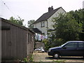

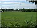
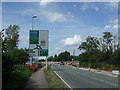
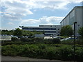
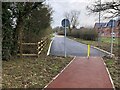
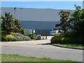
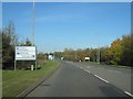
22 photos from this area
Area Information
Key information about the MK7 7SL including its size, population, and administrative classification.
- Area Type
- Postcode
- Area Size
- 6619 m²
- Population
- 1559
- Population Density
- 3249 people/km²
House Prices in MK7 7SL
24
Properties
£171,385
Average Sold Price
£48,000
Lowest Price
£310,000
Highest Price
Showing 24 properties
| Address | Type | Beds | Baths | Last Sale Price | Last Sale Date | |
|---|---|---|---|---|---|---|
| 18 Isaacson Drive, Wavendon Gate, Milton Keynes, MK7 7SL | Semi-detached | 2 | 1 | £310,000 | Aug 2025 | |
| 8 Isaacson Drive, Wavendon Gate, Milton Keynes, MK7 7SL | Semi-detached | 2 | 1 | £278,000 | May 2024 | |
| 26 Isaacson Drive, Wavendon Gate, Milton Keynes, MK7 7SL | house | - | - | £300,000 | Sep 2022 | |
| 12 Isaacson Drive, Wavendon Gate, Milton Keynes, MK7 7SL | house | - | - | £270,400 | Feb 2022 | |
| 34 Isaacson Drive, Wavendon Gate, Milton Keynes, MK7 7SL | Semi-detached | 2 | 1 | £242,000 | Dec 2020 | |
| 38 Isaacson Drive, Wavendon Gate, Milton Keynes, MK7 7SL | Terraced | 2 | 1 | £239,000 | Mar 2019 | |
| 44 Isaacson Drive, Wavendon Gate, Milton Keynes, MK7 7SL | house | 2 | - | £64,950 | Oct 2017 | |
| 28 Isaacson Drive, Wavendon Gate, Milton Keynes, MK7 7SL | Semi-detached | 2 | - | £215,500 | Oct 2015 | |
| 48 Isaacson Drive, Wavendon Gate, Milton Keynes, MK7 7SL | Semi-detached | 2 | 2 | £197,000 | May 2015 | |
| 10 Isaacson Drive, Wavendon Gate, Milton Keynes, MK7 7SL | Semi-detached | 2 | 1 | £196,600 | Dec 2014 |
Page 1 of 3
Energy Efficiency in MK7 7SL
Amenities
Schools
| Rank | School | Type | Entry gender | Ages |
|---|
Explore more schools in this area
Go to Schools tabDemographics
Household Size
Family (3-5 people)
most common
Accommodation Type
Houses
most common
Tenure
36
majority
Ethnic Group
White
most common
Religion
N/A
most common
Household Composition
N/A
most common
Age
47
median
Adults (30-64 years)
most common
Household Deprivation
N/A
with no deprivation
NS-SEC
28
in Lower managerial occupations
Explore more demographic insights in this area
Go to Demographics tabPlanning
Planning Constraints
- Flood RiskPremium
- Ramsar Wetland SitesPremium
- Area of Outstanding Natural BeautyPremium
- Protected Nature ReservePremium
- Protected WoodlandPremium