Area Overview for MK7 7PG
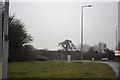
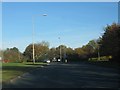
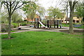
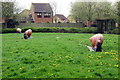
Photos of MK7 7PG


Area Information
MK7 7PG is a compact postcode area in England, covering just 5,240 square metres and home to 1,494 residents. Its high population density—285,091 people per square kilometre—reflects a tightly woven community where proximity to services and amenities is a defining feature. This small residential cluster is part of a broader network of local infrastructure, with schools, rail links, and retail hubs within easy reach. The area’s character is shaped by its balance of suburban tranquillity and practical connectivity, making it appealing to families and professionals seeking convenience without sacrificing space. With a median age of 47 and a majority of residents aged 30–64, the community is largely composed of established adults, many of whom own their homes. Daily life here revolves around local schools, nearby rail stations, and the ease of access to Milton Keynes’ broader offerings, all within a walkable or short drive. The area’s compact size ensures a sense of cohesion, though its small footprint means every decision about living here is influenced by proximity to key services.
- Area Type
- Postcode
- Area Size
- 5240 m²
- Population
- 1494
- Population Density
- 4244 people/km²
The property market in MK7 7PG is characterised by a high rate of home ownership—59%—with houses being the predominant accommodation type. This suggests a community where long-term residency is common, and properties are likely to be family homes rather than short-term rentals. The small area size—just 5,240 square metres—means the housing stock is limited, potentially leading to competition among buyers. The concentration of houses may also imply a focus on traditional, possibly larger properties compared to flats or apartments. For prospective buyers, this small area’s immediate surroundings offer proximity to schools, rail networks, and retail hubs, which could be a significant draw. However, the compact nature of MK7 7PG means that property availability is unlikely to be vast, and buyers may need to consider nearby postcodes for more options. The high home ownership rate also suggests that the area is less reliant on rental demand, which could influence property prices and market dynamics.
House Prices in MK7 7PG
No properties found in this postcode.
Energy Efficiency in MK7 7PG
Living in MK7 7PG offers access to a range of amenities within close proximity. The area is served by five retail outlets, including Tesco Walnut, The Southern Co-operative Co, and Tesco Milton Keynes Old, providing everyday shopping needs. These stores are likely to cater to both household essentials and local services, supporting a self-contained lifestyle. The presence of five rail stations—Bow Brickhill, Fenny Stratford, and Woburn Sands—enhances mobility, allowing residents to reach larger towns or cities quickly. Cranfield Airport adds another layer of connectivity, particularly for those requiring regional travel. While the data does not specify dining or leisure venues, the compact nature of the area suggests that local cafes, pubs, or parks may be nearby, contributing to a community-focused environment. The combination of retail, transport, and nearby natural or recreational spaces—though not explicitly listed—implies that daily life in MK7 7PG balances practicality with the convenience of a tightly integrated neighbourhood.
Amenities
Schools
MK7 7PG is served by a mix of primary schools and academies, offering families a range of educational options. Heronsgate School and Heronshaw School are both primary institutions, while Heronsgate School and Heronshaw School also operate as academies with Ofsted ratings of ‘good’. This dual structure means parents can choose between traditional primary education or the structured, often more resource-intensive model of academies. The presence of two schools with the same names suggests a possible overlap in catchment areas or distinct campuses, though the data does not clarify this. The ‘good’ Ofsted ratings indicate that both schools meet or exceed national standards, providing reassurance for families prioritising educational quality. The proximity of these schools to residential properties in MK7 7PG means that children can access schooling without long commutes, supporting a family-friendly environment. The availability of two schools with similar names may also reflect a deliberate effort to provide multiple choices within the area, though further details on their curricula or specialisms are not included in the data.
| Rank | School | Type | Entry gender | Ages |
|---|
Explore more schools in this area
Go to Schools tabDemographics
The population of MK7 7PG is predominantly composed of adults aged 30–64, with a median age of 47. This suggests a mature, stable community with a strong presence of families and long-term residents. Home ownership is high at 59%, indicating a mix of owner-occupied properties and rental units, though the data does not specify the latter’s proportion. The accommodation type is primarily houses, which aligns with the area’s residential character. The predominant ethnic group is White, reflecting the broader demographic patterns of the region. The high population density—285,091 people per square kilometre—means the area is intensely populated for its size, which can influence the pace of life and availability of shared spaces. While this density supports a vibrant local economy and frequent social interaction, it also underscores the need for efficient planning to manage resources like parking and green space. The data does not indicate levels of deprivation, but the high home ownership and age profile suggest a relatively stable, middle-income demographic.
Household Size
Accommodation Type
Tenure
Ethnic Group
Religion
Household Composition
Age
Household Deprivation
NS-SEC
Explore more demographic insights in this area
Go to Demographics tabPlanning
Planning Constraints
- Flood RiskPremium
- Ramsar Wetland SitesPremium
- Area of Outstanding Natural BeautyPremium
- Protected Nature ReservePremium
- Protected WoodlandPremium