Area Overview for MK7 7BW
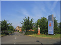
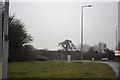
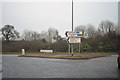
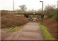
Photos of MK7 7BW


Area Information
MK7 7BW is a compact residential postcode in England, spanning just 1.7 hectares and home to 1,494 residents. Its high population density of 89,273 people per square kilometre reflects a tightly knit community, ideal for those seeking proximity to amenities without sacrificing space. The area’s appeal lies in its balance of practicality and accessibility, with nearby schools, rail links, and retail hubs within easy reach. Residents benefit from a low crime risk, with a safety score of 85, and excellent broadband connectivity rated at 100. While the area lacks natural conservation zones, its focus on everyday convenience makes it suitable for families and professionals. The presence of multiple primary schools and academies, along with rail stations like Bow Brickhill and Woburn Sands, ensures a well-connected lifestyle. For buyers, MK7 7BW offers a snapshot of suburban living, where small-scale housing and community-oriented infrastructure converge.
- Area Type
- Postcode
- Area Size
- 1.7 hectares
- Population
- 1494
- Population Density
- 4244 people/km²
MK7 7BW is a largely owner-occupied area, with 59% of residents owning their homes. The housing stock is dominated by houses, which suggests a preference for standalone properties over flats or apartments. This configuration is typical of suburban or semi-rural settings where privacy and space are prioritised. Given the small size of the postcode area, the housing market is likely limited in scale, with properties concentrated in a compact cluster. Buyers should consider that the area’s proximity to rail stations and schools may influence property values, though the absence of significant planning constraints or natural features means the market is unlikely to be driven by niche factors. For those seeking a home with a balance of security, convenience, and traditional housing, MK7 7BW offers a straightforward option.
House Prices in MK7 7BW
No properties found in this postcode.
Energy Efficiency in MK7 7BW
MK7 7BW offers a range of amenities that support daily life, from retail to transport. Nearby shops include Tesco Walnut, The Southern Co-operative Co, and Tesco Milton Keynes Old, providing access to groceries, household essentials, and local services. The rail network, with stations such as Bow Brickhill and Woburn Sands, ensures easy travel to surrounding areas, while Cranfield Airport adds convenience for those requiring air travel. Though the area lacks detailed information on parks or leisure facilities, its proximity to schools and retail hubs suggests a focus on practicality over expansive recreational spaces. The combination of nearby amenities and efficient transport links makes MK7 7BW a functional choice for those prioritising convenience and connectivity.
Amenities
Schools
Residents of MK7 7BW have access to four schools within practical reach. These include Heronsgate School and Heronshaw School, both of which operate as primary schools. Additionally, Heronsgate School and Heronshaw School are listed as academies with a good Ofsted rating. This mix of primary and academy schools provides families with options that cater to different educational preferences. The presence of two schools with the same name suggests potential for expanded capacity or shared resources, though specific details on their curricula or facilities are not provided. The good Ofsted ratings indicate a baseline standard of education, which is a key consideration for families prioritising academic quality.
| Rank | School | Type | Entry gender | Ages |
|---|
Explore more schools in this area
Go to Schools tabDemographics
The population of MK7 7BW has a median age of 47, with the majority of residents aged between 30 and 64. This suggests a mature, stable community with a strong presence of working-age adults. Home ownership stands at 59%, indicating a mix of long-term residents and property investors. The area is predominantly composed of houses, reflecting a preference for family-friendly housing over flats. The predominant ethnic group is White, though specific data on diversity or deprivation is not provided. The high proportion of adults in the 30-64 age range implies a focus on established households, possibly with children in local schools. This demographic profile aligns with the area’s practical amenities and safe environment, making it appealing to those seeking a settled, low-maintenance lifestyle.
Household Size
Accommodation Type
Tenure
Ethnic Group
Religion
Household Composition
Age
Household Deprivation
NS-SEC
Explore more demographic insights in this area
Go to Demographics tabPlanning
Planning Constraints
- Flood RiskPremium
- Ramsar Wetland SitesPremium
- Area of Outstanding Natural BeautyPremium
- Protected Nature ReservePremium
- Protected WoodlandPremium