Area Overview for MK5 6FF
Photos of MK5 6FF
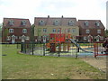


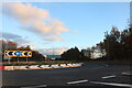


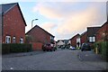
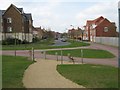
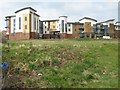
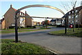
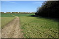
19 photos from this area
Area Information
Key information about the MK5 6FF including its size, population, and administrative classification.
- Area Type
- Postcode
- Area Size
- 5.4 hectares
- Population
- 1318
- Population Density
- 1632 people/km²
House Prices in MK5 6FF
74
Properties
£266,182
Average Sold Price
£149,995
Lowest Price
£875,000
Highest Price
Showing 74 properties
| Address | Type | Beds | Baths | Last Sale Price | Last Sale Date | |
|---|---|---|---|---|---|---|
| 7 Darwin Close, Medbourne, Milton Keynes, MK5 6FF | Detached | 4 | 2 | £625,000 | Sep 2025 | |
| 49 Darwin Close, Medbourne, Milton Keynes, MK5 6FF | Flat | - | - | £270,000 | Mar 2025 | |
| 44 Darwin Close, Medbourne, Milton Keynes, MK5 6FF | Flat | - | - | £260,000 | Jan 2025 | |
| 55 Darwin Close, Medbourne, Milton Keynes, MK5 6FF | Flat | 3 | 2 | £268,500 | Feb 2024 | |
| 21 Darwin Close, Medbourne, Milton Keynes, MK5 6FF | Flat | - | - | £280,000 | Jun 2023 | |
| 68 Darwin Close, Medbourne, Milton Keynes, MK5 6FF | Detached | 5 | 3 | £875,000 | May 2023 | |
| 35 Darwin Close, Medbourne, Milton Keynes, MK5 6FF | Semi-detached | 3 | 1 | £395,000 | Aug 2022 | |
| 54 Darwin Close, Medbourne, Milton Keynes, MK5 6FF | Flat | 3 | 2 | £280,000 | Jul 2022 | |
| 60 Darwin Close, Medbourne, Milton Keynes, MK5 6FF | Flat | 3 | 2 | £280,000 | Apr 2022 | |
| 63 Darwin Close, Medbourne, Milton Keynes, MK5 6FF | Detached | 4 | 2 | £560,000 | Nov 2021 |
Page 1 of 8
Energy Efficiency in MK5 6FF
Amenities
Schools
| Rank | School | Type | Entry gender | Ages |
|---|
Explore more schools in this area
Go to Schools tabDemographics
Household Size
One person
most common
Accommodation Type
Flats
most common
Tenure
70
majority
Ethnic Group
White
most common
Religion
N/A
most common
Household Composition
N/A
most common
Age
47
median
Adults (30-64 years)
most common
Household Deprivation
N/A
with no deprivation
NS-SEC
25
in Lower managerial occupations
Explore more demographic insights in this area
Go to Demographics tabPlanning
Planning Constraints
- Flood RiskPremium
- Ramsar Wetland SitesPremium
- Area of Outstanding Natural BeautyPremium
- Protected Nature ReservePremium
- Protected WoodlandPremium