Area Overview for MK5 6FP
Photos of MK5 6FP
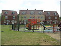
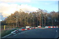
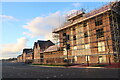
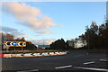


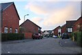
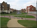
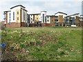
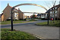
19 photos from this area
Area Information
Key information about the MK5 6FP including its size, population, and administrative classification.
- Area Type
- Postcode
- Area Size
- 4.6 hectares
- Population
- 1490
- Population Density
- 2859 people/km²
House Prices in MK5 6FP
66
Properties
£221,548
Average Sold Price
£82,500
Lowest Price
£330,000
Highest Price
Showing 66 properties
| Address | Type | Beds | Baths | Last Sale Price | Last Sale Date | |
|---|---|---|---|---|---|---|
| 112 Kirkwood Grove, Medbourne, Milton Keynes, MK5 6FP | Maisonette | 2 | 2 | £250,000 | Sep 2025 | |
| 28A Kirkwood Grove, Medbourne, Milton Keynes, MK5 6FP | Flat | 1 | 1 | £82,500 | Aug 2025 | |
| 80 Kirkwood Grove, Medbourne, Milton Keynes, MK5 6FP | house | 3 | 3 | £325,000 | Nov 2023 | |
| 108 Kirkwood Grove, Medbourne, Milton Keynes, MK5 6FP | Maisonette | 2 | 2 | £260,000 | Nov 2022 | |
| 70 Kirkwood Grove, Medbourne, Milton Keynes, MK5 6FP | Terraced | 3 | 2 | £330,000 | Mar 2022 | |
| 98 Kirkwood Grove, Medbourne, Milton Keynes, MK5 6FP | Flat | 2 | 2 | £242,500 | Mar 2022 | |
| 78 Kirkwood Grove, Medbourne, Milton Keynes, MK5 6FP | house | 3 | - | £305,000 | Aug 2021 | |
| 92 Kirkwood Grove, Medbourne, Milton Keynes, MK5 6FP | Maisonette | 2 | - | £245,000 | Aug 2021 | |
| 104 Kirkwood Grove, Medbourne, Milton Keynes, MK5 6FP | Flat | - | - | £235,000 | Feb 2018 | |
| 38A Kirkwood Grove, Medbourne, Milton Keynes, MK5 6FP | Flat | 2 | 2 | £216,000 | Jul 2017 |
Page 1 of 7
Energy Efficiency in MK5 6FP
Amenities
Schools
| Rank | School | Type | Entry gender | Ages |
|---|
Explore more schools in this area
Go to Schools tabDemographics
Household Size
Family (3-5 people)
most common
Accommodation Type
Houses
most common
Tenure
56
majority
Ethnic Group
White
most common
Religion
N/A
most common
Household Composition
N/A
most common
Age
47
median
Adults (30-64 years)
most common
Household Deprivation
N/A
with no deprivation
NS-SEC
43
in Lower managerial occupations
Explore more demographic insights in this area
Go to Demographics tabPlanning
Planning Constraints
- Flood RiskPremium
- Ramsar Wetland SitesPremium
- Area of Outstanding Natural BeautyPremium
- Protected Nature ReservePremium
- Protected WoodlandPremium