Area Overview for MK19 7DX
Photos of MK19 7DX
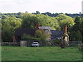
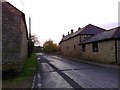
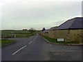
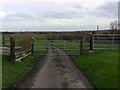
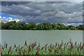
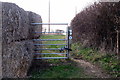
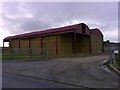
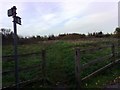
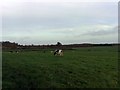

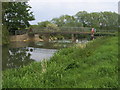
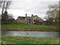
17 photos from this area
Area Information
Key information about the MK19 7DX including its size, population, and administrative classification.
- Area Type
- Postcode
- Area Size
- 37.8 hectares
- Population
- 1556
- Population Density
- 150 people/km²
House Prices in MK19 7DX
23
Properties
£398,455
Average Sold Price
£94,000
Lowest Price
£645,000
Highest Price
Showing 23 properties
| Address | Type | Beds | Baths | Last Sale Price | Last Sale Date | |
|---|---|---|---|---|---|---|
| September Cottage, 40 High Street, Haversham, MK19 7DX | house | - | - | £285,000 | Jun 2021 | |
| Harvest House, 26A High Street, Haversham, MK19 7DX | house | - | - | £626,000 | May 2020 | |
| 42 High Street, Haversham, MK19 7DX | Terraced | - | - | £370,000 | Mar 2016 | |
| Dower House, 26 High Street, Haversham, MK19 7DX | Detached | 7 | - | £645,000 | Aug 2014 | |
| 28 High Street, Haversham, MK19 7DX | Detached | 4 | - | £595,000 | Sep 2013 | |
| 20 High Street, Haversham, MK19 7DX | house | - | - | £350,000 | Sep 2012 | |
| Frost Cottage, 16 High Street, Haversham, MK19 7DX | house | - | - | £285,000 | Feb 2012 | |
| Grange Barn, High Street, Haversham, MK19 7DX | Detached | 4 | 3 | £575,000 | Dec 2003 | |
| 32 High Street, Haversham, MK19 7DX | Detached | - | - | £308,000 | Jun 2002 | |
| 34 High Street, Haversham, MK19 7DX | Detached | 4 | 2 | £250,000 | May 2001 |
Page 1 of 3
Energy Efficiency in MK19 7DX
Amenities
Schools
| Rank | School | Type | Entry gender | Ages |
|---|
Explore more schools in this area
Go to Schools tabDemographics
Household Size
Family (3-5 people)
most common
Accommodation Type
Houses
most common
Tenure
67
majority
Ethnic Group
White
most common
Religion
N/A
most common
Household Composition
N/A
most common
Age
47
median
Adults (30-64 years)
most common
Household Deprivation
N/A
with no deprivation
NS-SEC
47
in Lower managerial occupations
Explore more demographic insights in this area
Go to Demographics tabPlanning
Planning Constraints
- Flood RiskPremium
- Ramsar Wetland SitesPremium
- Area of Outstanding Natural BeautyPremium
- Protected Nature ReservePremium
- Protected WoodlandPremium