Area Overview for MK18 3AS
Photos of MK18 3AS
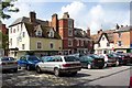


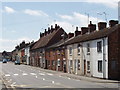
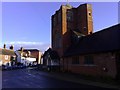
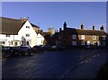
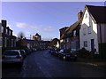
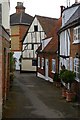
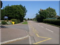
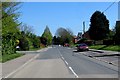
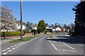
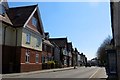
95 photos from this area
Area Information
Key information about the MK18 3AS including its size, population, and administrative classification.
- Area Type
- Postcode
- Area Size
- 1.4 hectares
- Population
- 1522
- Population Density
- 242 people/km²
House Prices in MK18 3AS
30
Properties
£298,779
Average Sold Price
£118,500
Lowest Price
£425,000
Highest Price
Showing 30 properties
| Address | Type | Beds | Baths | Last Sale Price | Last Sale Date | |
|---|---|---|---|---|---|---|
| 4 Missenden Road, Winslow, MK18 3AS | Semi-detached | 3 | 1 | £425,000 | Dec 2024 | |
| 10 Missenden Road, Winslow, MK18 3AS | Semi-detached | 3 | 1 | £399,950 | Aug 2024 | |
| 16 Missenden Road, Winslow, MK18 3AS | Semi-detached | 3 | - | £410,000 | Mar 2018 | |
| 52 Missenden Road, Winslow, MK18 3AS | house | - | - | £260,000 | Jun 2016 | |
| 12 Missenden Road, Winslow, MK18 3AS | house | 1 | 1 | £288,000 | Oct 2013 | |
| 48 Missenden Road, Winslow, MK18 3AS | Semi-detached | 4 | 1 | £190,000 | Oct 2009 | |
| 14 Missenden Road, Winslow, MK18 3AS | Semi-detached | 1 | 1 | £118,500 | Jul 2000 | |
| 2A Missenden Road, Winslow, MK18 3AS | Bungalow | 1 | 1 | - | - | |
| 34 Missenden Road, Winslow, MK18 3AS | Bungalow | - | - | - | - | |
| 20 Missenden Road, Winslow, MK18 3AS | Bungalow | - | - | - | - |
Page 1 of 3
Energy Efficiency in MK18 3AS
Amenities
Schools
| Rank | School | Type | Entry gender | Ages |
|---|
Explore more schools in this area
Go to Schools tabDemographics
Household Size
Two person
most common
Accommodation Type
Houses
most common
Tenure
59
majority
Ethnic Group
White
most common
Religion
N/A
most common
Household Composition
N/A
most common
Age
47
median
Adults (30-64 years)
most common
Household Deprivation
N/A
with no deprivation
NS-SEC
35
in Lower managerial occupations
Explore more demographic insights in this area
Go to Demographics tabPlanning
Planning Constraints
- Flood RiskPremium
- Ramsar Wetland SitesPremium
- Area of Outstanding Natural BeautyPremium
- Protected Nature ReservePremium
- Protected WoodlandPremium