Area Overview for MK18 3BN
Photos of MK18 3BN
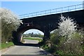
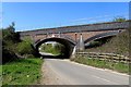
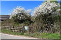
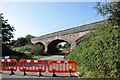
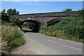
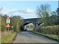
12 photos from this area
Area Information
Key information about the MK18 3BN including its size, population, and administrative classification.
- Area Type
- Postcode
- Area Size
- 49.0 hectares
- Population
- 1522
- Population Density
- 242 people/km²
House Prices in MK18 3BN
26
Properties
£345,273
Average Sold Price
£95,000
Lowest Price
£655,000
Highest Price
Showing 26 properties
| Address | Type | Beds | Baths | Last Sale Price | Last Sale Date | |
|---|---|---|---|---|---|---|
| 3 Verney Road, Winslow, MK18 3BN | Semi-detached | 4 | 2 | £315,000 | Jan 2025 | |
| Sunset Cottage, 69 Verney Road, Winslow, MK18 3BN | house | 3 | - | £326,000 | Feb 2021 | |
| 39 Verney Road, Winslow, MK18 3BN | house | - | - | £655,000 | Nov 2018 | |
| 9 Verney Road, Winslow, MK18 3BN | Semi-detached | 3 | - | £269,000 | Aug 2017 | |
| 31 Verney Road, Winslow, MK18 3BN | house | - | - | £480,000 | Jun 2017 | |
| 51 Verney Road, Winslow, MK18 3BN | Detached | 4 | 2 | £600,000 | Aug 2016 | |
| 7 Verney Road, Winslow, MK18 3BN | house | 3 | - | £218,000 | Aug 2014 | |
| 15 Verney Road, Winslow, MK18 3BN | Semi-detached | 3 | 2 | £230,000 | Jun 2014 | |
| 33 Verney Road, Winslow, MK18 3BN | house | 4 | - | £270,000 | Jan 2010 | |
| 49 Verney Road, Winslow, MK18 3BN | Detached | - | - | £340,000 | Jan 2009 |
Page 1 of 3
Energy Efficiency in MK18 3BN
Amenities
Schools
| Rank | School | Type | Entry gender | Ages |
|---|
Explore more schools in this area
Go to Schools tabDemographics
Household Size
Two person
most common
Accommodation Type
Houses
most common
Tenure
59
majority
Ethnic Group
White
most common
Religion
N/A
most common
Household Composition
N/A
most common
Age
47
median
Adults (30-64 years)
most common
Household Deprivation
N/A
with no deprivation
NS-SEC
35
in Lower managerial occupations
Explore more demographic insights in this area
Go to Demographics tabPlanning
Planning Constraints
- Flood RiskPremium
- Ramsar Wetland SitesPremium
- Area of Outstanding Natural BeautyPremium
- Protected Nature ReservePremium
- Protected WoodlandPremium