Area Overview for MK18 2FE
Photos of MK18 2FE
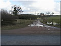
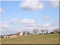
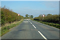
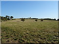
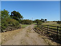
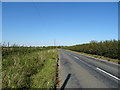
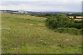
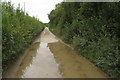
13 photos from this area
Area Information
Key information about the MK18 2FE including its size, population, and administrative classification.
- Area Type
- Postcode
- Area Size
- 19.5 hectares
- Population
- 2469
- Population Density
- 80 people/km²
House Prices in MK18 2FE
24
Properties
£323,210
Average Sold Price
£189,000
Lowest Price
£550,000
Highest Price
Showing 24 properties
| Address | Type | Beds | Baths | Last Sale Price | Last Sale Date | |
|---|---|---|---|---|---|---|
| 15 Tudors Close, Calvert Green, MK18 2FE | house | - | - | £375,000 | Nov 2025 | |
| 18 Tudors Close, Calvert Green, MK18 2FE | Detached | 3 | 2 | £355,000 | Sep 2025 | |
| 7 Tudors Close, Calvert Green, MK18 2FE | house | - | - | £550,000 | Sep 2021 | |
| 16 Tudors Close, Calvert Green, MK18 2FE | Terraced | 3 | 3 | £310,000 | Sep 2021 | |
| 23 Tudors Close, Calvert Green, MK18 2FE | Semi-detached | 3 | 3 | £352,000 | Jan 2019 | |
| 20 Tudors Close, Calvert Green, MK18 2FE | Terraced | 3 | 2 | £290,000 | May 2018 | |
| 24 Tudors Close, Calvert Green, MK18 2FE | house | - | - | £285,000 | Jul 2016 | |
| 21 Tudors Close, Calvert Green, MK18 2FE | Terraced | 3 | 3 | £265,000 | Apr 2016 | |
| 5 Tudors Close, Calvert Green, MK18 2FE | Detached | 5 | 3 | £422,500 | Jul 2014 | |
| 14 Tudors Close, Calvert Green, MK18 2FE | Detached | 5 | - | £360,000 | Jun 2013 |
Page 1 of 3
Energy Efficiency in MK18 2FE
Amenities
Schools
| Rank | School | Type | Entry gender | Ages |
|---|
Explore more schools in this area
Go to Schools tabDemographics
Household Size
Family (3-5 people)
most common
Accommodation Type
Houses
most common
Tenure
78
majority
Ethnic Group
White
most common
Religion
N/A
most common
Household Composition
N/A
most common
Age
47
median
Adults (30-64 years)
most common
Household Deprivation
N/A
with no deprivation
NS-SEC
43
in Lower managerial occupations
Explore more demographic insights in this area
Go to Demographics tabPlanning
Planning Constraints
- Flood RiskPremium
- Ramsar Wetland SitesPremium
- Area of Outstanding Natural BeautyPremium
- Protected Nature ReservePremium
- Protected WoodlandPremium