Area Overview for ME9 8LY
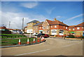
Photos of ME9 8LY

Area Information
Living in ME9 8LY offers a compact, well-defined residential experience within a small cluster of homes. With a population of 1,937 spread across 1.2 hectares, the area maintains a low density of 196 people per square kilometre, fostering a quiet, community-oriented atmosphere. This postcode is characterised by its predominantly owner-occupied housing stock, with 82% of residents living in their own homes. The median age of 47 suggests a stable, mature demographic, with the majority of residents falling within the 30-64 age range. Daily life here is likely shaped by proximity to local amenities, including retail hubs and rail connections, while the absence of major environmental constraints ensures a straightforward living environment. The area’s small size means it is ideal for those seeking a manageable, low-maintenance neighbourhood without the complexities of urban density.
- Area Type
- Postcode
- Area Size
- 1.2 hectares
- Population
- 1937
- Population Density
- 196 people/km²
The property market in ME9 8LY is defined by high home ownership and a focus on residential houses. With 82% of properties owner-occupied, this area is not a rental hotspot but rather a place where long-term residents are likely to stay. The predominance of houses over flats suggests a market appealing to families or individuals seeking more space and privacy. Given the small size of the postcode—just 1.2 hectares—the housing stock is limited, meaning buyers should consider the immediate surrounding areas for additional options. The low population density and absence of planning constraints imply that property values may be stable, with fewer speculative pressures. For buyers, this represents a straightforward market with minimal complexity, though the small footprint means competition for available homes could be keen.
House Prices in ME9 8LY
Showing 30 properties
| Address | Type | Beds | Baths | Last Sale Price | Last Sale Date | |
|---|---|---|---|---|---|---|
| 20 Kingfisher Close, Iwade, ME9 8LY | Semi-detached | 3 | 2 | £325,000 | Aug 2024 | |
| 7 Kingfisher Close, Iwade, ME9 8LY | Semi-detached | 2 | 1 | £275,000 | May 2024 | |
| 24 Kingfisher Close, Iwade, ME9 8LY | house | - | - | £550,000 | Apr 2023 | |
| 4 Kingfisher Close, Iwade, ME9 8LY | Semi-detached | 3 | 2 | £365,000 | Jul 2022 | |
| 17 Kingfisher Close, Iwade, ME9 8LY | house | - | - | £350,000 | Jul 2022 | |
| 15 Kingfisher Close, Iwade, ME9 8LY | Retail | 3 | 2 | £335,000 | May 2022 | |
| 25 Kingfisher Close, Iwade, ME9 8LY | Detached | 4 | 2 | £480,000 | Mar 2022 | |
| 5 Kingfisher Close, Iwade, ME9 8LY | Semi-detached | 3 | - | £312,000 | May 2021 | |
| 6 Kingfisher Close, Iwade, ME9 8LY | Semi-detached | 3 | - | £290,000 | Jan 2021 | |
| 21 Kingfisher Close, Iwade, ME9 8LY | Detached | 3 | 1 | £330,000 | Jan 2021 |
Energy Efficiency in ME9 8LY
The lifestyle in ME9 8LY is shaped by its proximity to practical amenities and transport links. Residents can access major retail chains such as Asda, Morrisons, and Tesco, ensuring everyday shopping needs are met without long commutes. The area’s rail network, with stations like Kemsley and Swale, provides easy access to nearby towns, enhancing both social and professional opportunities. While the data does not specify parks or leisure facilities, the absence of environmental constraints like protected woodlands or AONB designations suggests a straightforward, unencumbered living experience. The combination of retail convenience and rail connectivity makes daily life efficient, with minimal need for car ownership.
Amenities
Schools
Residents of ME9 8LY have access to two educational institutions: Iwade Community Primary School, a primary school serving younger children, and Iwade School, which operates as an academy. The presence of both a primary school and an academy offers families a choice between traditional state education and the potentially more specialised or autonomous structure of an academy. While specific Ofsted ratings are not provided, the existence of two schools within proximity suggests a commitment to local education infrastructure. For families, this combination may provide flexibility depending on their child’s needs, though the limited number of schools means careful consideration of catchment areas and transportation logistics is essential.
| Rank | School | Type | Entry gender | Ages |
|---|
Explore more schools in this area
Go to Schools tabDemographics
ME9 8LY is a mature community with a median age of 47, reflecting a population skewed towards adults aged 30-64. This age group constitutes the most common demographic, suggesting a stable, established neighbourhood with limited presence of younger families or retirees. Home ownership is high, with 82% of residents living in properties they own, predominantly in houses rather than flats. The predominant ethnic group is White, though specific diversity metrics are not provided. The population density of 196 people per square kilometre indicates a low-pressure environment, where social interactions are likely to be neighbourly and familiar. This demographic profile aligns with a community focused on long-term residency, with limited turnover of properties or residents.
Household Size
Accommodation Type
Tenure
Ethnic Group
Religion
Household Composition
Age
Household Deprivation
NS-SEC
Explore more demographic insights in this area
Go to Demographics tabPlanning
Planning Constraints
- Flood RiskPremium
- Ramsar Wetland SitesPremium
- Area of Outstanding Natural BeautyPremium
- Protected Nature ReservePremium
- Protected WoodlandPremium