Area Overview for ME9 8FW
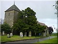
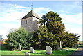
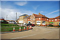
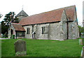
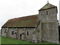
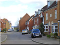
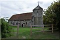
Photos of ME9 8FW

Area Information
ME9 8FW is a compact residential postcode in England, covering just 5.3 hectares and home to 1,937 residents. Its small size means it is a tightly knit community, with a population density of 196 people per square kilometre. The area is characterised by a mature demographic, with a median age of 47 and a majority of residents aged between 30 and 64. This suggests a stable, established community where many residents have lived for years. The area’s housing stock is predominantly owner-occupied, with 82% of homes owned by their occupants, reflecting a strong sense of local investment. Nearby, Iwade Community Primary School and Iwade School provide education options, while rail links to Kemsley, Swale, and Sittingbourne stations offer easy access to surrounding towns. Daily life here balances quiet residential living with practical connectivity, making it appealing to those seeking a settled, low-maintenance lifestyle without sacrificing accessibility.
- Area Type
- Postcode
- Area Size
- 5.3 hectares
- Population
- 1937
- Population Density
- 196 people/km²
ME9 8FW is a small, owner-occupied area where 82% of homes are owned by their occupants. The housing stock is predominantly houses, which is typical of areas with a mature demographic and limited new development. The compact size of the postcode—just 5.3 hectares—means the property market is tightly defined, with limited scope for expansion or new builds. This makes the area attractive to buyers seeking established homes in a quiet, low-density setting. However, the small size also means the market is niche, with fewer options for those looking to move within the immediate vicinity. Buyers should consider the area’s proximity to rail links and nearby towns like Sittingbourne, which may provide additional property choices outside the postcode itself.
House Prices in ME9 8FW
Showing 18 properties
| Address | Type | Beds | Baths | Last Sale Price | Last Sale Date | |
|---|---|---|---|---|---|---|
| 22 Fulmar Avenue, Iwade, ME9 8FW | Terraced | 2 | 1 | £225,000 | Aug 2020 | |
| 3 Fulmar Avenue, Iwade, ME9 8FW | Terraced | 5 | 3 | £450,000 | Sep 2018 | |
| 1 Fulmar Avenue, Iwade, ME9 8FW | house | - | - | £269,000 | Dec 2016 | |
| 6 Fulmar Avenue, Iwade, ME9 8FW | house | 4 | - | £267,500 | Aug 2014 | |
| 5 Fulmar Avenue, Iwade, ME9 8FW | house | - | - | £201,995 | Jun 2012 | |
| 12 Fulmar Avenue, Iwade, ME9 8FW | house | - | - | £207,000 | Apr 2012 | |
| 8 Fulmar Avenue, Iwade, ME9 8FW | Detached | 4 | 1 | - | - | |
| 10 Fulmar Avenue, Iwade, ME9 8FW | house | - | - | - | - | |
| 7 Fulmar Avenue, Iwade, ME9 8FW | house | - | - | - | - | |
| 4 Fulmar Avenue, Iwade, ME9 8FW | house | - | - | - | - |
Energy Efficiency in ME9 8FW
The lifestyle in ME9 8FW is shaped by its proximity to retail and transport hubs. Nearby, Asda Sittingbourne, Morrisons Daily Milton Regis 97, and Tesco Quartz provide essential shopping options, reducing the need for long trips to larger centres. The rail network connects residents to Kemsley, Swale, and Sittingbourne, offering access to a wider range of services, dining, and leisure opportunities. While the area itself is small, its location ensures residents can enjoy the convenience of local amenities without sacrificing the tranquillity of a residential postcode. The mix of retail outlets and transport links creates a practical, self-contained environment, ideal for those prioritising ease of access over sprawling urban sprawl.
Amenities
Schools
Residents of ME9 8FW have access to two primary educational institutions: Iwade Community Primary School, which serves younger children, and Iwade School, a secondary academy. The presence of both a primary school and an academy suggests a range of educational options for families, though the data does not specify Ofsted ratings or academic performance. The mix of school types may appeal to parents seeking a traditional primary education followed by a more specialised or independent secondary curriculum. Both schools are likely to be within practical walking or driving distance, making them accessible for local families. The availability of two schools in the area supports a community-focused approach to education, reducing the need for long commutes to larger towns.
| Rank | School | Type | Entry gender | Ages |
|---|
Explore more schools in this area
Go to Schools tabDemographics
The population of ME9 8FW is predominantly adults aged 30 to 64, with a median age of 47. This suggests a community of established professionals and families, many of whom have likely lived in the area for years. Home ownership is high at 82%, indicating a strong preference for long-term residency over rental properties. The area’s accommodation is primarily houses, which aligns with the demographic profile of older, more settled residents. The predominant ethnic group is White, reflecting the broader trends in this part of England. The population density of 196 people per square kilometre is moderate for a rural or semi-rural postcode, suggesting a balance between private space and community interaction. The absence of specific deprivation data means the area’s quality of life is likely supported by its stable demographics and infrastructure.
Household Size
Accommodation Type
Tenure
Ethnic Group
Religion
Household Composition
Age
Household Deprivation
NS-SEC
Explore more demographic insights in this area
Go to Demographics tabPlanning
Planning Constraints
- Flood RiskPremium
- Ramsar Wetland SitesPremium
- Area of Outstanding Natural BeautyPremium
- Protected Nature ReservePremium
- Protected WoodlandPremium