Area Overview for ME9 7RU
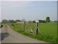
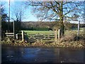
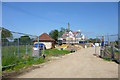
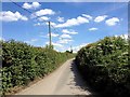
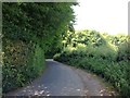
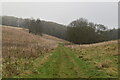
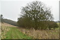
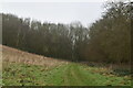
Photos of ME9 7RU
Area Information
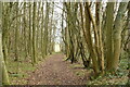
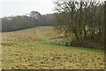
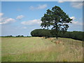
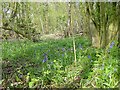
Living in ME9 7RU means inhabiting a small, tightly knit residential cluster in England’s countryside. The area covers 43.7 hectares and is home to 1,853 residents, giving it a population density of 97 people per square kilometre. This is a mature community, with a median age of 47 and most residents falling into the 30-64 age range. The area’s compact size and low population density suggest a quiet, rural lifestyle, far from urban congestion. Housing here is predominantly owner-occupied, with 82% of homes owned by their occupants, and the accommodation type is largely houses rather than flats. This reflects a stable, family-oriented demographic. The area is not within any major conservation designations, though it borders protected natural spaces. Daily life here balances proximity to essential amenities with a sense of seclusion, making it appealing to those seeking a slower pace without sacrificing access to services.
- Area Type
- Postcode
- Area Size
- 43.7 hectares
- Population
- 1853
- Population Density
- 97 people/km²
The property market in ME9 7RU is characterised by high home ownership and a focus on single-family homes. With 82% of properties owned by their occupants, this is not a rental-heavy area, which may appeal to buyers seeking long-term stability. The accommodation type is exclusively houses, indicating a lack of flats or apartments. This suggests a market skewed towards larger, more traditional properties, likely suited to families or individuals prioritising space and privacy. The small area size and limited population density mean the housing stock is relatively constrained, which could affect availability for new buyers. However, the absence of major planning restrictions—apart from proximity to protected natural areas—may make it easier to find properties without development restrictions. For those seeking a quiet, owner-occupied home, ME9 7RU offers a niche market with a focus on established, family-friendly housing.
House Prices in ME9 7RU
Showing 1 properties
| Address | Type | Beds | Baths | Last Sale Price | Last Sale Date | |
|---|---|---|---|---|---|---|
| Appsfield Farm, Rumstead Lane, Hucking, ME9 7RU | Farm | - | - | - | - |
Energy Efficiency in ME9 7RU
Life in ME9 7RU is shaped by its proximity to essential amenities and a rural setting. Within reach are five rail stations, including Hollingbourne and Bearsted, offering connections to larger towns and cities. Retail options such as M&S Medway, Tesco Bearsted, and Co-op Rainham provide everyday shopping needs, while the area’s small size ensures these venues are not far from homes. The absence of major leisure or entertainment hubs means the lifestyle here is more subdued, focusing on practicality and convenience. The rural character of the area, combined with accessible transport, creates a balance between seclusion and connectivity. For those valuing a quiet, low-stress environment with nearby services, this area offers a straightforward, functional lifestyle.
Amenities
Schools
The nearest school to ME9 7RU is Detling Church of England Primary School, a primary institution serving local children. No secondary schools are listed in the data, so families requiring secondary education would need to look beyond the immediate area. The presence of a primary school suggests that the area is well-suited for young families, though the lack of nearby secondary options may require commuting. The school’s type and performance are not specified, but its existence provides a foundation for early education. For those prioritising proximity to schools, this primary institution is a key asset. However, the absence of secondary schooling highlights a potential limitation for households with older children.
| Rank | School | Type | Entry gender | Ages |
|---|
Explore more schools in this area
Go to Schools tabDemographics
ME9 7RU’s population is defined by its age profile and home ownership rates. With a median age of 47, the area is predominantly populated by adults in their 30s to 60s, suggesting a community of established professionals and families. The 82% home ownership rate indicates a strong preference for long-term residency, with few rental properties. The accommodation type is exclusively houses, which aligns with the area’s rural character and the presence of larger properties. The predominant ethnic group is White, though no specific diversity data is provided. The low population density of 97 people per square kilometre implies a spread-out, low-pressure living environment. This demographic structure suggests a community focused on stability and continuity, with fewer transient residents. For those considering this area, the age profile and ownership rates hint at a mature, settled population with potential for long-term investment.
Household Size
Accommodation Type
Tenure
Ethnic Group
Religion
Household Composition
Age
Household Deprivation
NS-SEC
Explore more demographic insights in this area
Go to Demographics tabPlanning
Planning Constraints
- Flood RiskPremium
- Ramsar Wetland SitesPremium
- Area of Outstanding Natural BeautyPremium
- Protected Nature ReservePremium
- Protected WoodlandPremium