Area Overview for ME14 3LR
Photos of ME14 3LR
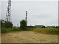


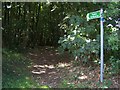
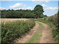
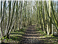


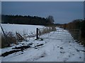
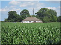
16 photos from this area
Area Information
Key information about the ME14 3LR including its size, population, and administrative classification.
- Area Type
- Postcode
- Area Size
- 1.2 km²
- Population
- 1853
- Population Density
- 97 people/km²
House Prices in ME14 3LR
11
Properties
-
Average Sold Price
-
Lowest Price
-
Highest Price
Showing 11 properties
| Address | Type | Beds | Baths | Last Sale Price | Last Sale Date | |
|---|---|---|---|---|---|---|
| Claras Annexe, Cold Blow Farm, Coldblow Lane, Thurnham, ME14 3LR | Semi-detached | 3 | 3 | - | - | |
| Little Budds Farm, Coldblow Lane, Thurnham, ME14 3LR | Detached | - | - | - | - | |
| Nick Vearsley Ltd, Radar Studio, Coldblow Lane, Thurnham, ME14 3LR | Industrial | - | - | - | - | |
| The Gate Annexe, Cold Blow Farm, Coldblow Lane, Thurnham, ME14 3LR | office_workshop | - | - | - | - | |
| Flint Cottage, Coldblow Lane, Thurnham, ME14 3LR | Semi-detached | - | - | - | - | |
| First Floor Livery Building, Coldblow Equestrian Training Centre, Coldblow Lane, Thurnham, ME14 3LR | Office | - | - | - | - | |
| Holiday Site, Cold Blow Farm, Coldblow Lane, Thurnham, ME14 3LR | hotel | - | - | - | - | |
| 1, Cold Blow Farm, Coldblow Lane, Thurnham, ME14 3LR | house | - | - | - | - | |
| 1, Brickfield Cottages, Coldblow Lane, Thurnham, ME14 3LR | Semi-detached | - | - | - | - | |
| Cold Blow Farm, Coldblow Lane, Thurnham, ME14 3LR | Bungalow | - | - | - | - |
Page 1 of 2
Energy Efficiency in ME14 3LR
Amenities
Schools
| Rank | School | Type | Entry gender | Ages |
|---|
Explore more schools in this area
Go to Schools tabDemographics
Household Size
Two person
most common
Accommodation Type
Houses
most common
Tenure
82
majority
Ethnic Group
White
most common
Religion
N/A
most common
Household Composition
N/A
most common
Age
47
median
Adults (30-64 years)
most common
Household Deprivation
N/A
with no deprivation
NS-SEC
46
in Lower managerial occupations
Explore more demographic insights in this area
Go to Demographics tabPlanning
Planning Constraints
- Flood RiskPremium
- Ramsar Wetland SitesPremium
- Area of Outstanding Natural BeautyPremium
- Protected Nature ReservePremium
- Protected WoodlandPremium