Area Overview for ME8 9RJ
Photos of ME8 9RJ
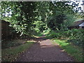
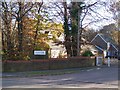
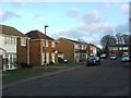
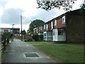
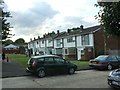
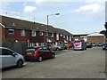
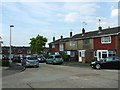
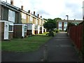
64 photos from this area
Area Information
Key information about the ME8 9RJ including its size, population, and administrative classification.
- Area Type
- Postcode
- Area Size
- 4348 m²
- Population
- 1533
- Population Density
- 7124 people/km²
House Prices in ME8 9RJ
16
Properties
£166,850
Average Sold Price
£84,000
Lowest Price
£275,000
Highest Price
Showing 16 properties
| Address | Type | Beds | Baths | Last Sale Price | Last Sale Date | |
|---|---|---|---|---|---|---|
| 19 Collet Walk, Parkwood, Gillingham, ME8 9RJ | Terraced | 3 | 1 | £275,000 | Jun 2023 | |
| 24 Collet Walk, Parkwood, Gillingham, ME8 9RJ | house | 2 | - | £255,000 | Sep 2021 | |
| 31 Collet Walk, Parkwood, Gillingham, ME8 9RJ | Terraced | 3 | 1 | £227,000 | Nov 2018 | |
| 30 Collet Walk, Parkwood, Gillingham, ME8 9RJ | Terraced | 2 | 1 | £165,000 | May 2015 | |
| 23 Collet Walk, Parkwood, Gillingham, ME8 9RJ | Terraced | - | - | £169,995 | May 2014 | |
| 35 Collet Walk, Parkwood, Gillingham, ME8 9RJ | house | - | - | £141,500 | Aug 2009 | |
| 33 Collet Walk, Parkwood, Gillingham, ME8 9RJ | Terraced | - | - | £135,000 | May 2005 | |
| 32 Collet Walk, Parkwood, Gillingham, ME8 9RJ | house | - | - | £125,000 | Nov 2002 | |
| 27 Collet Walk, Parkwood, Gillingham, ME8 9RJ | Terraced | - | - | £91,000 | May 2002 | |
| 29 Collet Walk, Parkwood, Gillingham, ME8 9RJ | house | - | - | £84,000 | Mar 2001 |
Page 1 of 2
Energy Efficiency in ME8 9RJ
Amenities
Schools
| Rank | School | Type | Entry gender | Ages |
|---|
Explore more schools in this area
Go to Schools tabDemographics
Household Size
Family (3-5 people)
most common
Accommodation Type
Houses
most common
Tenure
78
majority
Ethnic Group
White
most common
Religion
N/A
most common
Household Composition
N/A
most common
Age
47
median
Adults (30-64 years)
most common
Household Deprivation
N/A
with no deprivation
NS-SEC
33
in Lower managerial occupations
Explore more demographic insights in this area
Go to Demographics tabPlanning
Planning Constraints
- Flood RiskPremium
- Ramsar Wetland SitesPremium
- Area of Outstanding Natural BeautyPremium
- Protected Nature ReservePremium
- Protected WoodlandPremium