Area Overview for ME8 7PW
Photos of ME8 7PW
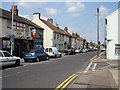
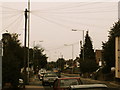

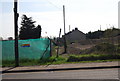
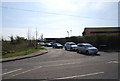
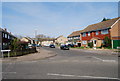
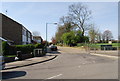
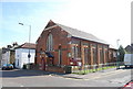
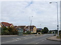
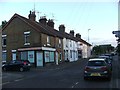
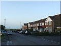
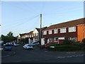
92 photos from this area
Area Information
Key information about the ME8 7PW including its size, population, and administrative classification.
- Area Type
- Postcode
- Area Size
- 6345 m²
- Population
- 1578
- Population Density
- 1894 people/km²
House Prices in ME8 7PW
20
Properties
£192,067
Average Sold Price
£71,000
Lowest Price
£347,000
Highest Price
Showing 20 properties
| Address | Type | Beds | Baths | Last Sale Price | Last Sale Date | |
|---|---|---|---|---|---|---|
| 14 Lambourne Place, Rainham, Gillingham, ME8 7PW | Terraced | 3 | 1 | £290,000 | Jun 2025 | |
| 12 Lambourne Place, Rainham, Gillingham, ME8 7PW | Terraced | 3 | 1 | £262,500 | Mar 2024 | |
| 2 Lambourne Place, Rainham, Gillingham, ME8 7PW | Terraced | 3 | 1 | £347,000 | Feb 2024 | |
| 5 Lambourne Place, Rainham, Gillingham, ME8 7PW | Terraced | 3 | 1 | £318,000 | Jun 2023 | |
| 9 Lambourne Place, Rainham, Gillingham, ME8 7PW | Terraced | 3 | 1 | £230,000 | Jul 2020 | |
| 3 Lambourne Place, Rainham, Gillingham, ME8 7PW | Terraced | 3 | 1 | £245,000 | May 2017 | |
| 1 Lambourne Place, Rainham, Gillingham, ME8 7PW | house | - | - | £197,000 | Jul 2014 | |
| 18 Lambourne Place, Rainham, Gillingham, ME8 7PW | house | - | - | £147,500 | Sep 2012 | |
| 6 Lambourne Place, Rainham, Gillingham, ME8 7PW | Terraced | - | - | £178,000 | Aug 2012 | |
| 19 Lambourne Place, Rainham, Gillingham, ME8 7PW | house | - | - | £164,500 | Dec 2009 |
Page 1 of 2
Energy Efficiency in ME8 7PW
Amenities
Schools
| Rank | School | Type | Entry gender | Ages |
|---|
Explore more schools in this area
Go to Schools tabDemographics
Household Size
Two person
most common
Accommodation Type
Houses
most common
Tenure
83
majority
Ethnic Group
White
most common
Religion
N/A
most common
Household Composition
N/A
most common
Age
47
median
Adults (30-64 years)
most common
Household Deprivation
N/A
with no deprivation
NS-SEC
35
in Lower managerial occupations
Explore more demographic insights in this area
Go to Demographics tabPlanning
Planning Constraints
- Flood RiskPremium
- Ramsar Wetland SitesPremium
- Area of Outstanding Natural BeautyPremium
- Protected Nature ReservePremium
- Protected WoodlandPremium