Area Overview for ME8 0JN
Photos of ME8 0JN
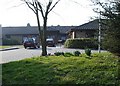

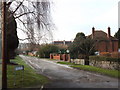
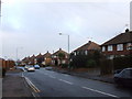
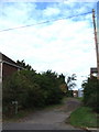
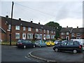
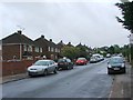
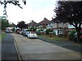
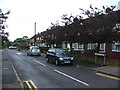
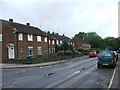
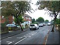
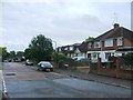
45 photos from this area
Area Information
Key information about the ME8 0JN including its size, population, and administrative classification.
- Area Type
- Postcode
- Area Size
- 1.4 hectares
- Population
- 1516
- Population Density
- 3643 people/km²
House Prices in ME8 0JN
22
Properties
£406,184
Average Sold Price
£94,000
Lowest Price
£760,000
Highest Price
Showing 22 properties
| Address | Type | Beds | Baths | Last Sale Price | Last Sale Date | |
|---|---|---|---|---|---|---|
| 67 Durham Road, Rainham, Gillingham, ME8 0JN | Detached | 5 | 4 | £760,000 | May 2024 | |
| 48 Durham Road, Rainham, Gillingham, ME8 0JN | house | - | - | £705,000 | Jun 2021 | |
| 62 Durham Road, Rainham, Gillingham, ME8 0JN | Bungalow | 2 | 2 | £400,000 | Apr 2021 | |
| 49 Durham Road, Rainham, Gillingham, ME8 0JN | Detached | 3 | 1 | £420,000 | Nov 2019 | |
| 35 Durham Road, Rainham, Gillingham, ME8 0JN | Semi-detached | 3 | 1 | £375,000 | Mar 2019 | |
| 54 Durham Road, Rainham, Gillingham, ME8 0JN | Detached | 5 | 3 | £670,000 | Feb 2017 | |
| 59 Durham Road, Rainham, Gillingham, ME8 0JN | Detached | 4 | - | £520,000 | Oct 2016 | |
| 55 Durham Road, Rainham, Gillingham, ME8 0JN | Detached | 4 | - | £430,000 | Dec 2014 | |
| 64 Durham Road, Rainham, Gillingham, ME8 0JN | Bungalow | 3 | - | £305,000 | Jan 2014 | |
| 69 Durham Road, Rainham, Gillingham, ME8 0JN | Detached | 4 | 2 | £395,000 | Apr 2010 |
Page 1 of 3
Energy Efficiency in ME8 0JN
Amenities
Schools
| Rank | School | Type | Entry gender | Ages |
|---|
Explore more schools in this area
Go to Schools tabDemographics
Household Size
Two person
most common
Accommodation Type
Houses
most common
Tenure
89
majority
Ethnic Group
White
most common
Religion
N/A
most common
Household Composition
N/A
most common
Age
47
median
Adults (30-64 years)
most common
Household Deprivation
N/A
with no deprivation
NS-SEC
36
in Lower managerial occupations
Explore more demographic insights in this area
Go to Demographics tabPlanning
Planning Constraints
- Flood RiskPremium
- Ramsar Wetland SitesPremium
- Area of Outstanding Natural BeautyPremium
- Protected Nature ReservePremium
- Protected WoodlandPremium