Area Overview for ME8 0ER
Photos of ME8 0ER

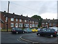
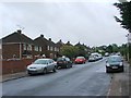
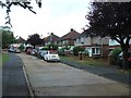
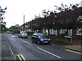
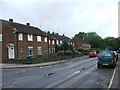
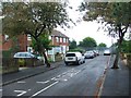
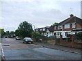
45 photos from this area
Area Information
Key information about the ME8 0ER including its size, population, and administrative classification.
- Area Type
- Postcode
- Area Size
- 7509 m²
- Population
- 1569
- Population Density
- 6093 people/km²
House Prices in ME8 0ER
20
Properties
£173,607
Average Sold Price
£110,000
Lowest Price
£262,000
Highest Price
Showing 20 properties
| Address | Type | Beds | Baths | Last Sale Price | Last Sale Date | |
|---|---|---|---|---|---|---|
| 8 Henley Close, Rainham, Gillingham, ME8 0ER | Terraced | 3 | 2 | £262,000 | Dec 2021 | |
| 15 Henley Close, Rainham, Gillingham, ME8 0ER | house | 2 | 1 | £232,000 | Jun 2021 | |
| 3 Henley Close, Rainham, Gillingham, ME8 0ER | Semi-detached | 4 | 1 | £245,000 | Jan 2020 | |
| 16 Henley Close, Rainham, Gillingham, ME8 0ER | Terraced | 3 | - | £202,000 | Jun 2017 | |
| 4 Henley Close, Rainham, Gillingham, ME8 0ER | Semi-detached | 2 | - | £220,000 | May 2017 | |
| 17 Henley Close, Rainham, Gillingham, ME8 0ER | house | - | - | £162,000 | Jul 2014 | |
| 14 Henley Close, Rainham, Gillingham, ME8 0ER | house | 3 | - | £151,000 | May 2014 | |
| 11 Henley Close, Rainham, Gillingham, ME8 0ER | Terraced | 4 | 2 | £165,000 | May 2014 | |
| 1 Henley Close, Rainham, Gillingham, ME8 0ER | house | 3 | - | £140,000 | May 2012 | |
| 5 Henley Close, Rainham, Gillingham, ME8 0ER | house | 2 | - | £121,000 | Jul 2010 |
Page 1 of 2
Energy Efficiency in ME8 0ER
Amenities
Schools
| Rank | School | Type | Entry gender | Ages |
|---|
Explore more schools in this area
Go to Schools tabDemographics
Household Size
Family (3-5 people)
most common
Accommodation Type
Houses
most common
Tenure
73
majority
Ethnic Group
White
most common
Religion
N/A
most common
Household Composition
N/A
most common
Age
47
median
Adults (30-64 years)
most common
Household Deprivation
N/A
with no deprivation
NS-SEC
31
in Lower managerial occupations
Explore more demographic insights in this area
Go to Demographics tabPlanning
Planning Constraints
- Flood RiskPremium
- Ramsar Wetland SitesPremium
- Area of Outstanding Natural BeautyPremium
- Protected Nature ReservePremium
- Protected WoodlandPremium