Area Overview for ME7 3RA
Photos of ME7 3RA
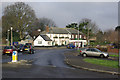
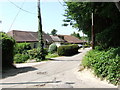
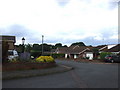
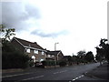
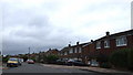
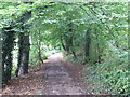
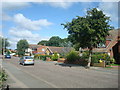
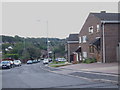
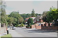
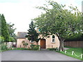
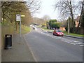
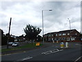
96 photos from this area
Area Information
Key information about the ME7 3RA including its size, population, and administrative classification.
- Area Type
- Postcode
- Area Size
- 1.5 hectares
- Population
- 1674
- Population Density
- 3485 people/km²
House Prices in ME7 3RA
36
Properties
£265,787
Average Sold Price
£90,000
Lowest Price
£420,000
Highest Price
Showing 36 properties
| Address | Type | Beds | Baths | Last Sale Price | Last Sale Date | |
|---|---|---|---|---|---|---|
| 8 Birch Grove, Hempstead, Gillingham, ME7 3RA | Semi-detached | 3 | 1 | £420,000 | Nov 2025 | |
| 30 Birch Grove, Hempstead, Gillingham, ME7 3RA | Semi-detached | 3 | 1 | £417,000 | Jun 2024 | |
| 36 Birch Grove, Hempstead, Gillingham, ME7 3RA | house | - | - | £370,000 | Oct 2022 | |
| 28 Birch Grove, Hempstead, Gillingham, ME7 3RA | Retail | 3 | 1 | £375,000 | Mar 2022 | |
| 40 Birch Grove, Hempstead, Gillingham, ME7 3RA | house | - | - | £335,000 | Apr 2021 | |
| 1 Birch Grove, Hempstead, Gillingham, ME7 3RA | Semi-detached | 3 | 2 | £385,000 | Sep 2018 | |
| 17 Birch Grove, Hempstead, Gillingham, ME7 3RA | Semi-detached | 3 | 1 | £345,000 | Mar 2018 | |
| 26 Birch Grove, Hempstead, Gillingham, ME7 3RA | Semi-detached | 3 | 2 | £371,500 | Sep 2017 | |
| 20 Birch Grove, Hempstead, Gillingham, ME7 3RA | Semi-detached | 3 | - | £385,000 | Jun 2017 | |
| 34 Birch Grove, Hempstead, Gillingham, ME7 3RA | house | - | - | £302,500 | Apr 2016 |
Page 1 of 4
Energy Efficiency in ME7 3RA
Amenities
Schools
| Rank | School | Type | Entry gender | Ages |
|---|
Explore more schools in this area
Go to Schools tabDemographics
Household Size
Family (3-5 people)
most common
Accommodation Type
Houses
most common
Tenure
89
majority
Ethnic Group
White
most common
Religion
N/A
most common
Household Composition
N/A
most common
Age
47
median
Adults (30-64 years)
most common
Household Deprivation
N/A
with no deprivation
NS-SEC
40
in Lower managerial occupations
Explore more demographic insights in this area
Go to Demographics tabPlanning
Planning Constraints
- Flood RiskPremium
- Ramsar Wetland SitesPremium
- Area of Outstanding Natural BeautyPremium
- Protected Nature ReservePremium
- Protected WoodlandPremium