Area Overview for ME7 1RQ
Photos of ME7 1RQ
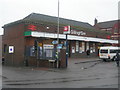
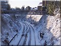
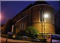
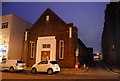
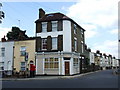
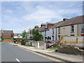
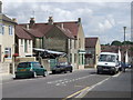
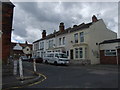
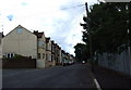
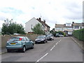
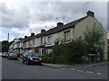
100 photos from this area
Area Information
Key information about the ME7 1RQ including its size, population, and administrative classification.
- Area Type
- Postcode
- Area Size
- 4579 m²
- Population
- 1279
- Population Density
- 8504 people/km²
House Prices in ME7 1RQ
27
Properties
£153,795
Average Sold Price
£32,995
Lowest Price
£250,000
Highest Price
Showing 27 properties
| Address | Type | Beds | Baths | Last Sale Price | Last Sale Date | |
|---|---|---|---|---|---|---|
| 145 Corporation Road, Gillingham, ME7 1RQ | Terraced | 2 | 1 | £237,500 | Mar 2025 | |
| 130 Corporation Road, Gillingham, ME7 1RQ | Terraced | 2 | 1 | £237,000 | Jun 2022 | |
| 122 Corporation Road, Gillingham, ME7 1RQ | Terraced | 3 | 1 | £250,000 | Dec 2021 | |
| 153 Corporation Road, Gillingham, ME7 1RQ | Terraced | 2 | 1 | £226,500 | Nov 2021 | |
| 149 Corporation Road, Gillingham, ME7 1RQ | Terraced | 2 | 2 | £187,000 | Sep 2021 | |
| 140 Corporation Road, Gillingham, ME7 1RQ | house | - | - | £190,000 | Feb 2021 | |
| 139 Corporation Road, Gillingham, ME7 1RQ | Terraced | 2 | - | £187,500 | Aug 2019 | |
| 138 Corporation Road, Gillingham, ME7 1RQ | Terraced | 2 | 1 | £180,000 | Jul 2019 | |
| 126 Corporation Road, Gillingham, ME7 1RQ | house | 2 | - | £175,000 | Apr 2019 | |
| 151 Corporation Road, Gillingham, ME7 1RQ | Terraced | 2 | 1 | £185,000 | Aug 2018 |
Page 1 of 3
Energy Efficiency in ME7 1RQ
Amenities
Schools
| Rank | School | Type | Entry gender | Ages |
|---|
Explore more schools in this area
Go to Schools tabDemographics
Household Size
Family (3-5 people)
most common
Accommodation Type
Houses
most common
Tenure
35
majority
Ethnic Group
White
most common
Religion
N/A
most common
Household Composition
N/A
most common
Age
47
median
Adults (30-64 years)
most common
Household Deprivation
N/A
with no deprivation
NS-SEC
15
in Lower managerial occupations
Explore more demographic insights in this area
Go to Demographics tabPlanning
Planning Constraints
- Flood RiskPremium
- Ramsar Wetland SitesPremium
- Area of Outstanding Natural BeautyPremium
- Protected Nature ReservePremium
- Protected WoodlandPremium