Area Overview for ME3 8AT
Photos of ME3 8AT


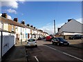
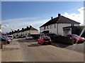
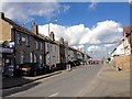
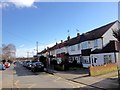
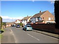
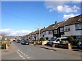
58 photos from this area
Area Information
Key information about the ME3 8AT including its size, population, and administrative classification.
- Area Type
- Postcode
- Area Size
- 2.1 hectares
- Population
- 2185
- Population Density
- 2513 people/km²
House Prices in ME3 8AT
33
Properties
£332,796
Average Sold Price
£170,000
Lowest Price
£515,000
Highest Price
Showing 33 properties
| Address | Type | Beds | Baths | Last Sale Price | Last Sale Date | |
|---|---|---|---|---|---|---|
| 99 Hollywood Lane, Wainscott, Rochester, ME3 8AT | Detached | 5 | 1 | £515,000 | Aug 2025 | |
| 89 Hollywood Lane, Wainscott, Rochester, ME3 8AT | Semi-detached | 3 | 1 | £375,000 | Mar 2024 | |
| 113 Hollywood Lane, Wainscott, Rochester, ME3 8AT | house | - | - | £430,000 | Jan 2023 | |
| 71 Hollywood Lane, Wainscott, Rochester, ME3 8AT | Semi-detached | 3 | 2 | £425,000 | Nov 2022 | |
| 93 Hollywood Lane, Wainscott, Rochester, ME3 8AT | Retail | 4 | 2 | £445,000 | Jul 2022 | |
| 103 Hollywood Lane, Wainscott, Rochester, ME3 8AT | Detached | 3 | 2 | £400,000 | Mar 2022 | |
| 89A Hollywood Lane, Wainscott, Rochester, ME3 8AT | house | - | - | £399,999 | Dec 2021 | |
| 111 Hollywood Lane, Wainscott, Rochester, ME3 8AT | house | - | - | £400,000 | Nov 2019 | |
| 121 Hollywood Lane, Wainscott, Rochester, ME3 8AT | Detached | 4 | 2 | £399,000 | Dec 2018 | |
| 115 Hollywood Lane, Wainscott, Rochester, ME3 8AT | house | - | - | £415,000 | Nov 2018 |
Page 1 of 4
Energy Efficiency in ME3 8AT
Amenities
Schools
| Rank | School | Type | Entry gender | Ages |
|---|
Explore more schools in this area
Go to Schools tabDemographics
Household Size
Family (3-5 people)
most common
Accommodation Type
Houses
most common
Tenure
87
majority
Ethnic Group
White
most common
Religion
N/A
most common
Household Composition
N/A
most common
Age
47
median
Adults (30-64 years)
most common
Household Deprivation
N/A
with no deprivation
NS-SEC
38
in Lower managerial occupations
Explore more demographic insights in this area
Go to Demographics tabPlanning
Planning Constraints
- Flood RiskPremium
- Ramsar Wetland SitesPremium
- Area of Outstanding Natural BeautyPremium
- Protected Nature ReservePremium
- Protected WoodlandPremium