Area Overview for ME2 4LZ
Photos of ME2 4LZ


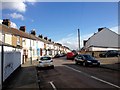
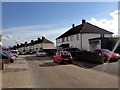
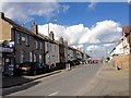
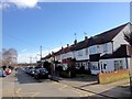
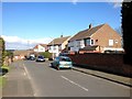
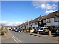
58 photos from this area
Area Information
Key information about the ME2 4LZ including its size, population, and administrative classification.
- Area Type
- Postcode
- Area Size
- 1.8 hectares
- Population
- 2185
- Population Density
- 2513 people/km²
House Prices in ME2 4LZ
35
Properties
£275,282
Average Sold Price
£89,995
Lowest Price
£400,000
Highest Price
Showing 35 properties
| Address | Type | Beds | Baths | Last Sale Price | Last Sale Date | |
|---|---|---|---|---|---|---|
| 5 Povey Avenue, Wainscott, Rochester, ME2 4LZ | Semi-detached | 3 | 1 | £395,000 | Jul 2025 | |
| 16 Povey Avenue, Wainscott, Rochester, ME2 4LZ | Terraced | 4 | 1 | £390,000 | May 2023 | |
| 38 Povey Avenue, Wainscott, Rochester, ME2 4LZ | house | - | - | £395,000 | May 2023 | |
| 4 Povey Avenue, Wainscott, Rochester, ME2 4LZ | house | - | - | £360,000 | Oct 2022 | |
| 24 Povey Avenue, Wainscott, Rochester, ME2 4LZ | house | - | - | £295,000 | Aug 2022 | |
| 2 Povey Avenue, Wainscott, Rochester, ME2 4LZ | Semi-detached | 4 | 1 | £380,000 | Mar 2020 | |
| 18 Povey Avenue, Wainscott, Rochester, ME2 4LZ | Terraced | 3 | 1 | £291,000 | Jul 2019 | |
| 34 Povey Avenue, Wainscott, Rochester, ME2 4LZ | Semi-detached | 1 | 1 | £245,000 | Feb 2019 | |
| 42 Povey Avenue, Wainscott, Rochester, ME2 4LZ | Semi-detached | 3 | 1 | £310,000 | May 2018 | |
| 19 Povey Avenue, Wainscott, Rochester, ME2 4LZ | Semi-detached | 4 | 2 | £400,000 | Sep 2017 |
Page 1 of 4
Energy Efficiency in ME2 4LZ
Amenities
Schools
| Rank | School | Type | Entry gender | Ages |
|---|
Explore more schools in this area
Go to Schools tabDemographics
Household Size
Family (3-5 people)
most common
Accommodation Type
Houses
most common
Tenure
87
majority
Ethnic Group
White
most common
Religion
N/A
most common
Household Composition
N/A
most common
Age
47
median
Adults (30-64 years)
most common
Household Deprivation
N/A
with no deprivation
NS-SEC
38
in Lower managerial occupations
Explore more demographic insights in this area
Go to Demographics tabPlanning
Planning Constraints
- Flood RiskPremium
- Ramsar Wetland SitesPremium
- Area of Outstanding Natural BeautyPremium
- Protected Nature ReservePremium
- Protected WoodlandPremium