Area Overview for ME20 6TS
Photos of ME20 6TS
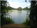
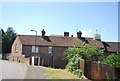
64 photos from this area
Area Information
Key information about the ME20 6TS including its size, population, and administrative classification.
- Area Type
- Postcode
- Area Size
- 1.2 hectares
- Population
- 2132
- Population Density
- 1884 people/km²
House Prices in ME20 6TS
24
Properties
£315,853
Average Sold Price
£120,000
Lowest Price
£567,500
Highest Price
Showing 24 properties
| Address | Type | Beds | Baths | Last Sale Price | Last Sale Date | |
|---|---|---|---|---|---|---|
| 18 Southey Way, Larkfield, Aylesford, ME20 6TS | Detached | 4 | 2 | £567,500 | Jan 2025 | |
| 15 Southey Way, Larkfield, Aylesford, ME20 6TS | Detached | 4 | 2 | £507,500 | Feb 2024 | |
| 24 Southey Way, Larkfield, Aylesford, ME20 6TS | house | - | - | £460,000 | Dec 2020 | |
| 9 Southey Way, Larkfield, Aylesford, ME20 6TS | house | - | - | £420,000 | Jan 2020 | |
| 19 Southey Way, Larkfield, Aylesford, ME20 6TS | house | - | - | £465,000 | Jul 2018 | |
| 7 Southey Way, Larkfield, Aylesford, ME20 6TS | Detached | 4 | 2 | £400,000 | Oct 2015 | |
| 5 Southey Way, Larkfield, Aylesford, ME20 6TS | Detached | 4 | 2 | £395,000 | Apr 2015 | |
| 16 Southey Way, Larkfield, Aylesford, ME20 6TS | house | 4 | - | £295,000 | Aug 2010 | |
| 17 Southey Way, Larkfield, Aylesford, ME20 6TS | house | - | - | £249,995 | Jul 2009 | |
| 22 Southey Way, Larkfield, Aylesford, ME20 6TS | Detached | 4 | 1 | £316,000 | Jul 2007 |
Page 1 of 3
Energy Efficiency in ME20 6TS
Amenities
Schools
| Rank | School | Type | Entry gender | Ages |
|---|
Explore more schools in this area
Go to Schools tabDemographics
Household Size
Two person
most common
Accommodation Type
Houses
most common
Tenure
80
majority
Ethnic Group
White
most common
Religion
N/A
most common
Household Composition
N/A
most common
Age
47
median
Adults (30-64 years)
most common
Household Deprivation
N/A
with no deprivation
NS-SEC
40
in Lower managerial occupations
Explore more demographic insights in this area
Go to Demographics tabPlanning
Planning Constraints
- Flood RiskPremium
- Ramsar Wetland SitesPremium
- Area of Outstanding Natural BeautyPremium
- Protected Nature ReservePremium
- Protected WoodlandPremium