Area Overview for ME20 6JA
Photos of ME20 6JA

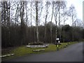
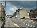
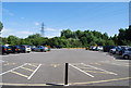
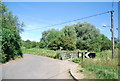

100 photos from this area
Area Information
Key information about the ME20 6JA including its size, population, and administrative classification.
- Area Type
- Postcode
- Area Size
- 15.7 hectares
- Population
- 2132
- Population Density
- 1884 people/km²
House Prices in ME20 6JA
12
Properties
£763,999
Average Sold Price
£299,995
Lowest Price
£1,975,000
Highest Price
Showing 12 properties
| Address | Type | Beds | Baths | Last Sale Price | Last Sale Date | |
|---|---|---|---|---|---|---|
| Great Lunsford Farm House, 470-472 Lunsford Lane, Larkfield, Aylesford, ME20 6JA | Detached | - | - | £950,000 | Nov 2021 | |
| 435 Lunsford Lane, Larkfield, Aylesford, ME20 6JA | house | 3 | 1 | £369,000 | Nov 2020 | |
| The Barn, 474 Lunsford Lane, Larkfield, Aylesford, ME20 6JA | Terraced | 5 | - | £1,975,000 | Oct 2020 | |
| 433 Lunsford Lane, Larkfield, Aylesford, ME20 6JA | house | - | - | £440,000 | Dec 2018 | |
| Blossom Barn, 480 Lunsford Lane, Larkfield, Aylesford, ME20 6JA | Detached | - | - | £550,000 | Oct 2009 | |
| 437 Lunsford Lane, Larkfield, Aylesford, ME20 6JA | Terraced | 6 | 3 | £299,995 | Apr 2006 | |
| May Cottage, 438 Lunsford Lane, Larkfield, Aylesford, ME20 6JA | Bungalow | 2 | 1 | - | - | |
| Rose Cottage, 440 Lunsford Lane, Larkfield, Aylesford, ME20 6JA | Detached | 4 | 3 | - | - | |
| Stable Building North Of, Little Lunsford Farm, 430 Lunsford Lane, Larkfield, Aylesford, ME20 6JA | Flat | - | - | - | - | |
| Broomwater, 478 Lunsford Lane, Larkfield, Aylesford, ME20 6JA | Detached | 2 | 1 | - | - |
Page 1 of 2
Energy Efficiency in ME20 6JA
Amenities
Schools
| Rank | School | Type | Entry gender | Ages |
|---|
Explore more schools in this area
Go to Schools tabDemographics
Household Size
Two person
most common
Accommodation Type
Houses
most common
Tenure
80
majority
Ethnic Group
White
most common
Religion
N/A
most common
Household Composition
N/A
most common
Age
47
median
Adults (30-64 years)
most common
Household Deprivation
N/A
with no deprivation
NS-SEC
40
in Lower managerial occupations
Explore more demographic insights in this area
Go to Demographics tabPlanning
Planning Constraints
- Flood RiskPremium
- Ramsar Wetland SitesPremium
- Area of Outstanding Natural BeautyPremium
- Protected Nature ReservePremium
- Protected WoodlandPremium