Area Overview for ME20 6BY
Photos of ME20 6BY

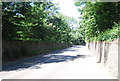
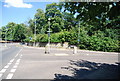


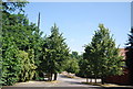
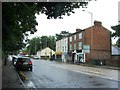
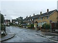

59 photos from this area
Area Information
Key information about the ME20 6BY including its size, population, and administrative classification.
- Area Type
- Postcode
- Area Size
- 1.8 hectares
- Population
- 2478
- Population Density
- 3326 people/km²
House Prices in ME20 6BY
41
Properties
£265,807
Average Sold Price
£45,800
Lowest Price
£485,000
Highest Price
Showing 41 properties
| Address | Type | Beds | Baths | Last Sale Price | Last Sale Date | |
|---|---|---|---|---|---|---|
| 33 Orchard Grove, Ditton, Aylesford, ME20 6BY | Detached | 3 | 1 | £425,000 | May 2025 | |
| 22 Orchard Grove, Ditton, Aylesford, ME20 6BY | house | - | - | £440,000 | Oct 2024 | |
| 16 Orchard Grove, Ditton, Aylesford, ME20 6BY | Semi-detached | 3 | 1 | £465,500 | Oct 2024 | |
| 19 Orchard Grove, Ditton, Aylesford, ME20 6BY | house | - | - | £465,000 | Nov 2022 | |
| 37 Orchard Grove, Ditton, Aylesford, ME20 6BY | house | - | - | £380,000 | Jun 2021 | |
| 15 Orchard Grove, Ditton, Aylesford, ME20 6BY | house | - | - | £287,500 | Apr 2021 | |
| 41 Orchard Grove, Ditton, Aylesford, ME20 6BY | house | - | - | £485,000 | Feb 2021 | |
| 3 Orchard Grove, Ditton, Aylesford, ME20 6BY | Terraced | 2 | 1 | £265,000 | Dec 2020 | |
| 17 Orchard Grove, Ditton, Aylesford, ME20 6BY | Semi-detached | 5 | - | £385,000 | Mar 2020 | |
| 34 Orchard Grove, Ditton, Aylesford, ME20 6BY | Semi-detached | 3 | 1 | £365,000 | Nov 2017 |
Page 1 of 5
Energy Efficiency in ME20 6BY
Amenities
Schools
| Rank | School | Type | Entry gender | Ages |
|---|
Explore more schools in this area
Go to Schools tabDemographics
Household Size
Family (3-5 people)
most common
Accommodation Type
Houses
most common
Tenure
71
majority
Ethnic Group
White
most common
Religion
N/A
most common
Household Composition
N/A
most common
Age
47
median
Adults (30-64 years)
most common
Household Deprivation
N/A
with no deprivation
NS-SEC
35
in Lower managerial occupations
Explore more demographic insights in this area
Go to Demographics tabPlanning
Planning Constraints
- Flood RiskPremium
- Ramsar Wetland SitesPremium
- Area of Outstanding Natural BeautyPremium
- Protected Nature ReservePremium
- Protected WoodlandPremium