Area Overview for ME20 6DL
Photos of ME20 6DL
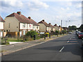


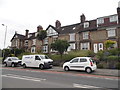

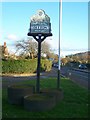


59 photos from this area
Area Information
Key information about the ME20 6DL including its size, population, and administrative classification.
- Area Type
- Postcode
- Area Size
- 1.5 hectares
- Population
- 2478
- Population Density
- 3326 people/km²
House Prices in ME20 6DL
26
Properties
£339,465
Average Sold Price
£64,500
Lowest Price
£720,000
Highest Price
Showing 26 properties
| Address | Type | Beds | Baths | Last Sale Price | Last Sale Date | |
|---|---|---|---|---|---|---|
| 551 London Road, Ditton, Aylesford, ME20 6DL | Detached | 4 | 2 | £598,000 | Nov 2025 | |
| 533 London Road, Ditton, Aylesford, ME20 6DL | Terraced | 3 | 2 | £392,500 | Feb 2023 | |
| 529 London Road, Ditton, Aylesford, ME20 6DL | Semi-detached | 4 | 1 | £425,000 | Jan 2022 | |
| 539 London Road, Ditton, Aylesford, ME20 6DL | house | - | - | £325,000 | Aug 2021 | |
| 575 London Road, Ditton, Aylesford, ME20 6DL | Detached | 6 | - | £720,000 | Mar 2021 | |
| 561 London Road, Ditton, Aylesford, ME20 6DL | house | - | - | £340,000 | Feb 2021 | |
| 565 London Road, Ditton, Aylesford, ME20 6DL | house | - | - | £435,000 | Jan 2021 | |
| 571 London Road, Ditton, Aylesford, ME20 6DL | house | - | - | £345,000 | Oct 2020 | |
| 555 London Road, Ditton, Aylesford, ME20 6DL | house | - | - | £348,000 | Oct 2019 | |
| 559 London Road, Ditton, Aylesford, ME20 6DL | house | - | - | £305,000 | May 2018 |
Page 1 of 3
Energy Efficiency in ME20 6DL
Amenities
Schools
| Rank | School | Type | Entry gender | Ages |
|---|
Explore more schools in this area
Go to Schools tabDemographics
Household Size
Family (3-5 people)
most common
Accommodation Type
Houses
most common
Tenure
71
majority
Ethnic Group
White
most common
Religion
N/A
most common
Household Composition
N/A
most common
Age
47
median
Adults (30-64 years)
most common
Household Deprivation
N/A
with no deprivation
NS-SEC
35
in Lower managerial occupations
Explore more demographic insights in this area
Go to Demographics tabPlanning
Planning Constraints
- Flood RiskPremium
- Ramsar Wetland SitesPremium
- Area of Outstanding Natural BeautyPremium
- Protected Nature ReservePremium
- Protected WoodlandPremium