Area Overview for ME2 2NJ
Photos of ME2 2NJ


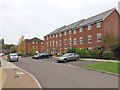
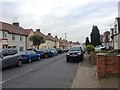
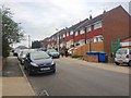


54 photos from this area
Area Information
Key information about the ME2 2NJ including its size, population, and administrative classification.
- Area Type
- Postcode
- Area Size
- 2.5 hectares
- Population
- 2419
- Population Density
- 3154 people/km²
House Prices in ME2 2NJ
26
Properties
£255,530
Average Sold Price
£64,000
Lowest Price
£488,000
Highest Price
Showing 26 properties
| Address | Type | Beds | Baths | Last Sale Price | Last Sale Date | |
|---|---|---|---|---|---|---|
| Redwick, 195 Cuxton Road, Strood, Rochester, ME2 2NJ | Bungalow | 2 | 1 | £315,000 | Jun 2024 | |
| Ivydene, 193 Cuxton Road, Strood, Rochester, ME2 2NJ | Bungalow | 3 | 2 | £259,795 | May 2022 | |
| Haytor, 167 Cuxton Road, Strood, Rochester, ME2 2NJ | Semi-detached | 2 | 1 | £270,000 | Nov 2019 | |
| Fairfield, 183 Cuxton Road, Strood, Rochester, ME2 2NJ | Bungalow | - | - | £240,000 | Feb 2018 | |
| Belmont, 165 Cuxton Road, Strood, Rochester, ME2 2NJ | Semi-detached | 3 | 1 | £350,000 | Feb 2018 | |
| Caldew Vale, 197 Cuxton Road, Strood, Rochester, ME2 2NJ | Bungalow | 2 | - | £129,000 | Jun 2013 | |
| Temple View, 157 Cuxton Road, Strood, Rochester, ME2 2NJ | house | - | - | £488,000 | Dec 2009 | |
| Stroma, 177 Cuxton Road, Strood, Rochester, ME2 2NJ | Semi-detached | - | - | £204,500 | May 2008 | |
| Clovelly, 169 Cuxton Road, Strood, Rochester, ME2 2NJ | house | - | - | £235,000 | Jul 2005 | |
| Castle View, 163 Cuxton Road, Strood, Rochester, ME2 2NJ | Semi-detached | - | - | £64,000 | Jan 1996 |
Page 1 of 3
Energy Efficiency in ME2 2NJ
Amenities
Schools
| Rank | School | Type | Entry gender | Ages |
|---|
Explore more schools in this area
Go to Schools tabDemographics
Household Size
Family (3-5 people)
most common
Accommodation Type
Houses
most common
Tenure
75
majority
Ethnic Group
White
most common
Religion
N/A
most common
Household Composition
N/A
most common
Age
47
median
Adults (30-64 years)
most common
Household Deprivation
N/A
with no deprivation
NS-SEC
31
in Lower managerial occupations
Explore more demographic insights in this area
Go to Demographics tabPlanning
Planning Constraints
- Flood RiskPremium
- Ramsar Wetland SitesPremium
- Area of Outstanding Natural BeautyPremium
- Protected Nature ReservePremium
- Protected WoodlandPremium