Area Overview for ME2 2NH
Photos of ME2 2NH


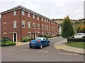
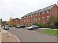
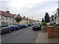
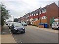
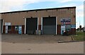


54 photos from this area
Area Information
Key information about the ME2 2NH including its size, population, and administrative classification.
- Area Type
- Postcode
- Area Size
- 2814 m²
- Population
- 1732
- Population Density
- 2362 people/km²
House Prices in ME2 2NH
9
Properties
£204,750
Average Sold Price
£100,000
Lowest Price
£310,000
Highest Price
Showing 9 properties
| Address | Type | Beds | Baths | Last Sale Price | Last Sale Date | |
|---|---|---|---|---|---|---|
| 166 Cuxton Road, Strood, Rochester, ME2 2NH | Retail | 3 | - | £310,000 | Mar 2022 | |
| 170 Cuxton Road, Strood, Rochester, ME2 2NH | Semi-detached | 3 | - | £250,000 | May 2016 | |
| 168 Cuxton Road, Strood, Rochester, ME2 2NH | house | - | - | £159,000 | Jan 2005 | |
| 174 Cuxton Road, Strood, Rochester, ME2 2NH | Semi-detached | 3 | 1 | £100,000 | Nov 2002 | |
| 160 Cuxton Road, Strood, Rochester, ME2 2NH | Semi-detached | 3 | - | - | - | |
| 164 Cuxton Road, Strood, Rochester, ME2 2NH | Semi-detached | - | - | - | - | |
| 172 Cuxton Road, Strood, Rochester, ME2 2NH | Semi-detached | 3 | 1 | - | - | |
| 162 Cuxton Road, Strood, Rochester, ME2 2NH | Semi-detached | - | - | - | - | |
| The Lodge, Strood Cemetery, Cuxton Road, Strood, Rochester, ME2 2NH | Detached | - | - | - | - |
Energy Efficiency in ME2 2NH
Amenities
Schools
| Rank | School | Type | Entry gender | Ages |
|---|
Explore more schools in this area
Go to Schools tabDemographics
Household Size
Family (3-5 people)
most common
Accommodation Type
Houses
most common
Tenure
65
majority
Ethnic Group
White
most common
Religion
N/A
most common
Household Composition
N/A
most common
Age
47
median
Adults (30-64 years)
most common
Household Deprivation
N/A
with no deprivation
NS-SEC
22
in Lower managerial occupations
Explore more demographic insights in this area
Go to Demographics tabPlanning
Planning Constraints
- Flood RiskPremium
- Ramsar Wetland SitesPremium
- Area of Outstanding Natural BeautyPremium
- Protected Nature ReservePremium
- Protected WoodlandPremium