Area Overview for ME2 2LH
Photos of ME2 2LH


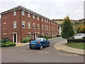
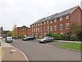
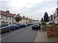
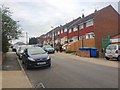


54 photos from this area
Area Information
Key information about the ME2 2LH including its size, population, and administrative classification.
- Area Type
- Postcode
- Area Size
- 7700 m²
- Population
- 1804
- Population Density
- 7561 people/km²
House Prices in ME2 2LH
27
Properties
£192,786
Average Sold Price
£87,500
Lowest Price
£340,000
Highest Price
Showing 27 properties
| Address | Type | Beds | Baths | Last Sale Price | Last Sale Date | |
|---|---|---|---|---|---|---|
| 5 Chestnut Road, Strood, Rochester, ME2 2LH | Maisonette | - | - | £143,000 | Oct 2023 | |
| 6 Chestnut Road, Strood, Rochester, ME2 2LH | Terraced | 3 | 2 | £300,000 | Jul 2023 | |
| 19 Chestnut Road, Strood, Rochester, ME2 2LH | house | 3 | 1 | £340,000 | Jul 2022 | |
| 20 Chestnut Road, Strood, Rochester, ME2 2LH | Semi-detached | 3 | 1 | £280,500 | Jan 2022 | |
| 12 Chestnut Road, Strood, Rochester, ME2 2LH | house | - | - | £286,000 | Aug 2021 | |
| 3 Chestnut Road, Strood, Rochester, ME2 2LH | Flat | 2 | 1 | £135,000 | Mar 2021 | |
| 1 Chestnut Road, Strood, Rochester, ME2 2LH | Flat | - | - | £135,000 | Mar 2021 | |
| 27 Chestnut Road, Strood, Rochester, ME2 2LH | Semi-detached | - | - | £235,000 | Apr 2016 | |
| 18 Chestnut Road, Strood, Rochester, ME2 2LH | Semi-detached | - | - | £200,000 | Jun 2015 | |
| 15 Chestnut Road, Strood, Rochester, ME2 2LH | Terraced | 3 | 1 | £115,000 | Jan 2011 |
Page 1 of 3
Energy Efficiency in ME2 2LH
Amenities
Schools
| Rank | School | Type | Entry gender | Ages |
|---|
Explore more schools in this area
Go to Schools tabDemographics
Household Size
Family (3-5 people)
most common
Accommodation Type
Houses
most common
Tenure
54
majority
Ethnic Group
White
most common
Religion
N/A
most common
Household Composition
N/A
most common
Age
47
median
Adults (30-64 years)
most common
Household Deprivation
N/A
with no deprivation
NS-SEC
20
in Lower managerial occupations
Explore more demographic insights in this area
Go to Demographics tabPlanning
Planning Constraints
- Flood RiskPremium
- Ramsar Wetland SitesPremium
- Area of Outstanding Natural BeautyPremium
- Protected Nature ReservePremium
- Protected WoodlandPremium