Area Overview for ME2 2LF
Photos of ME2 2LF


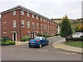
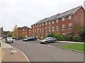
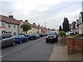
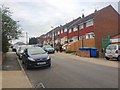


54 photos from this area
Area Information
Key information about the ME2 2LF including its size, population, and administrative classification.
- Area Type
- Postcode
- Area Size
- 1.5 hectares
- Population
- 2416
- Population Density
- 3479 people/km²
House Prices in ME2 2LF
31
Properties
£171,050
Average Sold Price
£53,500
Lowest Price
£285,000
Highest Price
Showing 31 properties
| Address | Type | Beds | Baths | Last Sale Price | Last Sale Date | |
|---|---|---|---|---|---|---|
| 79 Lilac Road, Strood, Rochester, ME2 2LF | Retail | 2 | 1 | £285,000 | Apr 2022 | |
| 45 Lilac Road, Strood, Rochester, ME2 2LF | house | - | - | £280,000 | Aug 2020 | |
| 42 Lilac Road, Strood, Rochester, ME2 2LF | Semi-detached | 2 | 1 | £242,000 | Mar 2020 | |
| 43 Lilac Road, Strood, Rochester, ME2 2LF | Semi-detached | 3 | 1 | £250,000 | Aug 2019 | |
| 38 Lilac Road, Strood, Rochester, ME2 2LF | Semi-detached | 2 | 1 | £230,000 | Jan 2019 | |
| 77 Lilac Road, Strood, Rochester, ME2 2LF | Semi-detached | 2 | 1 | £253,000 | Jan 2018 | |
| 47 Lilac Road, Strood, Rochester, ME2 2LF | Semi-detached | 3 | 1 | £226,750 | Feb 2016 | |
| 61 Lilac Road, Strood, Rochester, ME2 2LF | Semi-detached | 3 | - | £179,000 | Mar 2015 | |
| 63 Lilac Road, Strood, Rochester, ME2 2LF | Semi-detached | - | - | £173,000 | Mar 2008 | |
| 71 Lilac Road, Strood, Rochester, ME2 2LF | Semi-detached | - | - | £91,500 | Feb 2002 |
Page 1 of 4
Energy Efficiency in ME2 2LF
Amenities
Schools
| Rank | School | Type | Entry gender | Ages |
|---|
Explore more schools in this area
Go to Schools tabDemographics
Household Size
Family (3-5 people)
most common
Accommodation Type
Houses
most common
Tenure
70
majority
Ethnic Group
White
most common
Religion
N/A
most common
Household Composition
N/A
most common
Age
47
median
Adults (30-64 years)
most common
Household Deprivation
N/A
with no deprivation
NS-SEC
28
in Lower managerial occupations
Explore more demographic insights in this area
Go to Demographics tabPlanning
Planning Constraints
- Flood RiskPremium
- Ramsar Wetland SitesPremium
- Area of Outstanding Natural BeautyPremium
- Protected Nature ReservePremium
- Protected WoodlandPremium