Area Overview for ME19 6HF
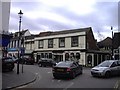
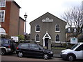
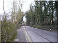
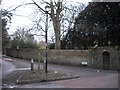
Photos of ME19 6HF


Area Information
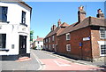
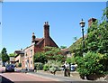
ME19 6HF is a compact residential postcode in England, covering 391 square metres and home to 1,586 residents. Its population density of 488 people per square kilometre suggests a tightly knit community, where proximity to local amenities and schools is a key feature. The area’s small size means it is likely centred around a core of homes with limited surrounding development, creating a quiet, localised feel. Daily life here is shaped by its modest scale—residents can walk to nearby shops, schools, and rail stations within minutes. The presence of multiple primary schools, including West Malling Church of England Primary School and More Park Catholic Primary School, indicates a focus on family living. While the area lacks large-scale infrastructure, its compact nature ensures a sense of familiarity and ease of navigation. For buyers, ME19 6HF offers a blend of practicality and simplicity, with homes positioned close to essential services. However, its limited size means the housing stock is finite, requiring buyers to act decisively if considering a move.
- Area Type
- Postcode
- Area Size
- 391 m²
- Population
- 1586
- Population Density
- 488 people/km²
ME19 6HF is primarily an owner-occupied area, with 58% of homes owned by their residents. The accommodation type is exclusively houses, which is unusual for a postcode of this size but suggests a focus on single-family homes rather than flats or apartments. This makes the area more attractive to buyers seeking traditional housing stock, though the limited number of properties means competition may be fierce. The small size of the postcode implies that the housing market is tightly bound to the immediate vicinity, with little scope for expansion. For buyers, this means properties are likely to be in high demand, particularly given the proximity to schools and transport links. However, the lack of rental properties indicates that the area is not a hotspot for investors seeking to let out homes. Those considering a purchase should be mindful of the limited supply and the potential for prices to be influenced by local demand.
House Prices in ME19 6HF
No properties found in this postcode.
Energy Efficiency in ME19 6HF
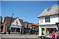
The lifestyle in ME19 6HF is defined by its proximity to practical amenities. Retail options include Tesco West, Spar, and Tesco Larkfield, providing access to groceries and daily essentials within walking distance. The area’s rail network, with stations at West Malling, East Malling, and New Hythe, ensures easy travel to nearby towns and cities, while Rochester Airport offers a regional connection for those requiring air travel. Although the area is small, these amenities contribute to a convenient, self-contained lifestyle. The presence of multiple schools and shops suggests a community-oriented environment where residents can meet local needs without long journeys. The lack of larger leisure facilities or parks is not specified in the data, but the combination of retail, transport, and education options implies a functional, practical way of life. For those prioritising ease of access over expansive recreational spaces, ME19 6HF offers a balanced approach.
Amenities
Schools
Residents of ME19 6HF have access to several primary schools, including West Malling Church of England Voluntary Controlled Primary School and Language Unit, More Park Catholic Primary School, and West Malling Church of England Primary School and McGinty Speech and Language Srp, which holds an Ofsted rating of ‘good’. The presence of multiple primary schools suggests a strong focus on education within the area, with options for both state and faith-based schooling. The duplication of More Park Catholic Primary School in the data may indicate a nearby branch or a typographical error, but the availability of at least two distinct schools provides families with choices. The ‘good’ rating at one of the schools highlights a standard of education that meets or exceeds national benchmarks. For families with children, this proximity to schools is a significant advantage, reducing the need for long commutes. However, no secondary schools are listed, meaning older children may need to travel further for secondary education.
| Rank | School | Type | Entry gender | Ages |
|---|
Explore more schools in this area
Go to Schools tabDemographics
The population of ME19 6HF has a median age of 47, with the majority of residents falling into the 30–64 age range. This suggests a community of established adults, many of whom may be in their prime working years or nearing retirement. Home ownership is strong, with 58% of households owning their homes, compared to 42% renting. The accommodation type is predominantly houses, reflecting a preference for detached or semi-detached properties over flats. The predominant ethnic group is White, though no specific data on diversity or deprivation is provided. The age profile indicates a stable, middle-aged population, which may influence local services and amenities. With no evidence of younger families or elderly residents in significant numbers, the area’s character is likely shaped by long-term residents. The lack of data on household composition or income levels means further analysis is not possible, but the existing figures suggest a community focused on stability and ownership.
Household Size
Accommodation Type
Tenure
Ethnic Group
Religion
Household Composition
Age
Household Deprivation
NS-SEC
Explore more demographic insights in this area
Go to Demographics tabPlanning
Planning Constraints
- Flood RiskPremium
- Ramsar Wetland SitesPremium
- Area of Outstanding Natural BeautyPremium
- Protected Nature ReservePremium
- Protected WoodlandPremium