Area Overview for ME19 6JZ
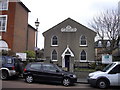
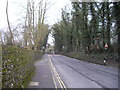
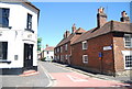
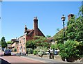
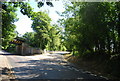
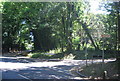
Photos of ME19 6JZ


Area Information
Living in ME19 6JZ means being part of a small, tightly knit residential cluster in England, where the population of 1,586 people is spread across a density of 488 people per square kilometre. This is a place where daily life revolves around local routines, with a mix of families and older residents shaping the community’s character. The area’s compact size means amenities and services are within easy reach, while its modest scale fosters a sense of familiarity. Residents benefit from proximity to primary schools, rail links, and retail outlets, making it practical for both commuters and those who prefer a slower pace. The median age of 47 suggests a mature population, with many households likely established in the area for years. While there is no dramatic landscape or major landmarks, ME19 6JZ offers stability, with low flood risk and no environmental constraints limiting development. For those seeking a quiet, functional living environment without the pressures of a larger city, this postcode provides a straightforward, no-frills alternative.
- Area Type
- Postcode
- Area Size
- Not available
- Population
- 1586
- Population Density
- 488 people/km²
The property market in ME19 6JZ is characterised by a 58% home ownership rate, with houses forming the primary accommodation type. This suggests a focus on owner-occupied properties rather than a rental-heavy market, though the small population and limited area mean housing stock is not extensive. The predominance of houses may indicate larger properties compared to flats, appealing to those seeking space and privacy. However, the area’s compact size means buyers must consider proximity to amenities and transport links as critical factors. With no data on property prices or recent sales, the market remains opaque, but the low flood risk and lack of environmental constraints may make it an attractive option for investors or first-time buyers seeking a stable, low-maintenance environment. The limited housing stock also means competition for available properties could be higher, particularly for those prioritising specific features like garden space or proximity to schools.
House Prices in ME19 6JZ
No properties found in this postcode.
Energy Efficiency in ME19 6JZ
The lifestyle in ME19 6JZ is shaped by its proximity to essential amenities. Five retail outlets, including Tesco West, Spar, and Tesco Larkfield, provide everyday shopping needs, while the three nearby railway stations offer access to broader networks for leisure or work. The presence of Rochester Airport adds to the area’s connectivity, though its use may be situational. For residents, the combination of local shops and transport links creates a balance between convenience and practicality. The absence of major parks or leisure facilities means outdoor activities may require travel, but the compact size of the area ensures a sense of cohesion. The retail and transport infrastructure supports a functional lifestyle, with no significant gaps in services. However, the lack of detailed data on cultural or recreational venues means the area’s character beyond basic amenities remains undefined.
Amenities
Schools
Residents of ME19 6JZ have access to several primary schools within reach, including West Malling Church of England Primary School and McGinty Speech and Language Srp, which holds an Ofsted rating of ‘good’. Other options include More Park Catholic Primary School and West Malling Church of England Voluntary Controlled Primary School and Language Unit. The presence of both church-affiliated and Catholic schools offers families a range of educational choices, though no secondary schools are listed in the data. The ‘good’ rating at one school indicates a standard of education that meets regulatory benchmarks, but the absence of detailed performance metrics means parents must rely on local reputation and personal visits to assess quality. For families prioritising school options, the proximity of multiple institutions within the area is a practical advantage, though the lack of higher education facilities may require commuting to nearby towns.
| Rank | School | Type | Entry gender | Ages |
|---|
Explore more schools in this area
Go to Schools tabDemographics
ME19 6JZ has a median age of 47, with the majority of residents falling within the 30-64 age range. This suggests a community of working-age adults and older individuals, likely with established careers and long-term residency. Home ownership stands at 58%, indicating a mix of owner-occupied properties and rental units. The accommodation type is predominantly houses, which may reflect a preference for private, detached living. The predominant ethnic group is White, though no data on diversity or deprivation levels is provided. The age profile implies a population that is neither heavily young nor elderly, balancing stability with active community participation. With no specific data on household composition, it is reasonable to infer a mix of single-person households, couples, and possibly small families. The absence of detailed diversity metrics means the community’s cultural makeup remains undefined in the data, but the age and ownership figures suggest a practical, settled demographic.
Household Size
Accommodation Type
Tenure
Ethnic Group
Religion
Household Composition
Age
Household Deprivation
NS-SEC
Explore more demographic insights in this area
Go to Demographics tabPlanning
Planning Constraints
- Flood RiskPremium
- Ramsar Wetland SitesPremium
- Area of Outstanding Natural BeautyPremium
- Protected Nature ReservePremium
- Protected WoodlandPremium