Area Overview for ME19 5EW
Photos of ME19 5EW


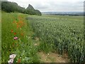
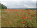
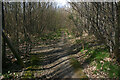

27 photos from this area
Area Information
Key information about the ME19 5EW including its size, population, and administrative classification.
- Area Type
- Postcode
- Area Size
- 62.5 hectares
- Population
- 1748
- Population Density
- 122 people/km²
House Prices in ME19 5EW
11
Properties
£575,000
Average Sold Price
£365,000
Lowest Price
£795,000
Highest Price
Showing 11 properties
| Address | Type | Beds | Baths | Last Sale Price | Last Sale Date | |
|---|---|---|---|---|---|---|
| The Little Cottage, Pilgrims Way, Trottiscliffe, West Malling, ME19 5EW | Detached | 3 | 2 | £565,000 | Jul 2022 | |
| Rosel, Pilgrims Way, Trottiscliffe, West Malling, ME19 5EW | Detached | 4 | 3 | £795,000 | Jul 2016 | |
| Hazeldene, Pilgrims Way, Trottiscliffe, West Malling, ME19 5EW | Detached | 4 | 2 | £365,000 | Dec 2001 | |
| Chidlands, Pilgrims Way, Trottiscliffe, West Malling, ME19 5EW | Detached | - | - | - | - | |
| Commority, Pilgrims Way, Trottiscliffe, West Malling, ME19 5EW | Detached | 4 | 1 | - | - | |
| Holmfield, Pilgrims Way, Trottiscliffe, West Malling, ME19 5EW | Detached | 4 | - | - | - | |
| The Warrens, Pilgrims Way, Trottiscliffe, West Malling, ME19 5EW | Detached | - | - | - | - | |
| Ad Astra, Pilgrims Way, Trottiscliffe, West Malling, ME19 5EW | Detached | - | - | - | - | |
| Walnut Lodge, Pilgrims Way, Trottiscliffe, West Malling, ME19 5EW | Detached | - | - | - | - | |
| Harpwood, Pilgrims Way, Trottiscliffe, West Malling, ME19 5EW | Detached | - | - | - | - |
Page 1 of 2
Energy Efficiency in ME19 5EW
Amenities
Schools
| Rank | School | Type | Entry gender | Ages |
|---|
Explore more schools in this area
Go to Schools tabDemographics
Household Size
Family (3-5 people)
most common
Accommodation Type
Houses
most common
Tenure
78
majority
Ethnic Group
White
most common
Religion
N/A
most common
Household Composition
N/A
most common
Age
47
median
Adults (30-64 years)
most common
Household Deprivation
N/A
with no deprivation
NS-SEC
46
in Lower managerial occupations
Explore more demographic insights in this area
Go to Demographics tabPlanning
Planning Constraints
- Flood RiskPremium
- Ramsar Wetland SitesPremium
- Area of Outstanding Natural BeautyPremium
- Protected Nature ReservePremium
- Protected WoodlandPremium