Area Overview for DA13 0UF
Photos of DA13 0UF
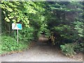
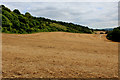
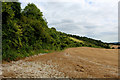
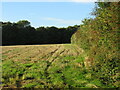
37 photos from this area
Area Information
Key information about the DA13 0UF including its size, population, and administrative classification.
- Area Type
- Postcode
- Area Size
- 1.4 km²
- Population
- 1748
- Population Density
- 122 people/km²
House Prices in DA13 0UF
10
Properties
£910,000
Average Sold Price
£600,000
Lowest Price
£1,175,000
Highest Price
Showing 10 properties
| Address | Type | Beds | Baths | Last Sale Price | Last Sale Date | |
|---|---|---|---|---|---|---|
| Harvel Lodge, 190 White Horse Road, Meopham, Gravesend, DA13 0UF | Detached | 6 | 4 | £1,175,000 | Oct 2020 | |
| Woodberry Down, White Horse Road, Harvel, Gravesend, DA13 0UF | Detached | 5 | 2 | £955,000 | Nov 2019 | |
| Tara, White Horse Road, Harvel, Gravesend, DA13 0UF | Bungalow | - | - | £600,000 | Oct 2015 | |
| Mobile At, Badgells Wood Camping, White Horse Road, Meopham, Gravesend, DA13 0UF | Detached | 5 | 3 | - | - | |
| ANNEXE AT, TARA, WHITE HORSE ROAD, Harvel, Gravesend, DA13 0UF | Flat | - | - | - | - | |
| Poundgate Barn, White Horse Road, Harvel, Gravesend, DA13 0UF | Detached | - | - | - | - | |
| Birling Farms, Badgells Wood Camping, White Horse Road, Meopham, Gravesend, DA13 0UF | commercial | - | - | - | - | |
| Poundgate Farm, White Horse Road, Harvel, Gravesend, DA13 0UF | Farm | - | - | - | - | |
| Highfield House, 62 White Horse Road, Meopham, Gravesend, DA13 0UF | house | - | - | - | - | |
| Poundgate, White Horse Road, Harvel, Gravesend, DA13 0UF | Detached | - | - | - | - |
Energy Efficiency in DA13 0UF
Amenities
Schools
| Rank | School | Type | Entry gender | Ages |
|---|
Explore more schools in this area
Go to Schools tabDemographics
Household Size
Family (3-5 people)
most common
Accommodation Type
Houses
most common
Tenure
78
majority
Ethnic Group
White
most common
Religion
N/A
most common
Household Composition
N/A
most common
Age
47
median
Adults (30-64 years)
most common
Household Deprivation
N/A
with no deprivation
NS-SEC
46
in Lower managerial occupations
Explore more demographic insights in this area
Go to Demographics tabPlanning
Planning Constraints
- Flood RiskPremium
- Ramsar Wetland SitesPremium
- Area of Outstanding Natural BeautyPremium
- Protected Nature ReservePremium
- Protected WoodlandPremium