Area Overview for ME18 5RP
Photos of ME18 5RP


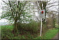
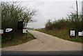
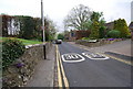

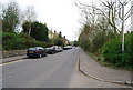


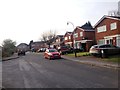
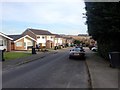
51 photos from this area
Area Information
Key information about the ME18 5RP including its size, population, and administrative classification.
- Area Type
- Postcode
- Area Size
- 4621 m²
- Population
- 1976
- Population Density
- 366 people/km²
House Prices in ME18 5RP
12
Properties
£288,750
Average Sold Price
£125,000
Lowest Price
£555,000
Highest Price
Showing 12 properties
| Address | Type | Beds | Baths | Last Sale Price | Last Sale Date | |
|---|---|---|---|---|---|---|
| 3 Rivers Close, Wateringbury, Maidstone, ME18 5RP | house | 4 | 2 | £555,000 | Apr 2022 | |
| 5 Rivers Close, Wateringbury, Maidstone, ME18 5RP | house | - | - | £526,000 | Apr 2021 | |
| 2 Rivers Close, Wateringbury, Maidstone, ME18 5RP | house | - | - | £309,500 | Jan 2013 | |
| 11 Rivers Close, Wateringbury, Maidstone, ME18 5RP | house | - | - | £334,500 | Nov 2012 | |
| 7 Rivers Close, Wateringbury, Maidstone, ME18 5RP | house | 3 | - | £270,000 | Jul 2012 | |
| 12 Rivers Close, Wateringbury, Maidstone, ME18 5RP | house | - | - | £320,000 | Jul 2010 | |
| 1 Rivers Close, Wateringbury, Maidstone, ME18 5RP | Detached | - | - | £320,000 | May 2005 | |
| 9 Rivers Close, Wateringbury, Maidstone, ME18 5RP | Detached | - | - | £236,000 | May 2004 | |
| 6 Rivers Close, Wateringbury, Maidstone, ME18 5RP | Detached | - | - | £174,000 | Apr 1999 | |
| 8 Rivers Close, Wateringbury, Maidstone, ME18 5RP | Detached | - | - | £125,000 | Jul 1998 |
Page 1 of 2
Energy Efficiency in ME18 5RP
Amenities
Schools
| Rank | School | Type | Entry gender | Ages |
|---|
Explore more schools in this area
Go to Schools tabDemographics
Household Size
Two person
most common
Accommodation Type
Houses
most common
Tenure
78
majority
Ethnic Group
White
most common
Religion
N/A
most common
Household Composition
N/A
most common
Age
47
median
Adults (30-64 years)
most common
Household Deprivation
N/A
with no deprivation
NS-SEC
45
in Lower managerial occupations
Explore more demographic insights in this area
Go to Demographics tabPlanning
Planning Constraints
- Flood RiskPremium
- Ramsar Wetland SitesPremium
- Area of Outstanding Natural BeautyPremium
- Protected Nature ReservePremium
- Protected WoodlandPremium