Area Overview for ME18 5DQ
Photos of ME18 5DQ


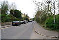
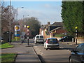
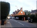
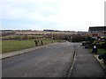
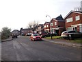
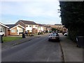
51 photos from this area
Area Information
Key information about the ME18 5DQ including its size, population, and administrative classification.
- Area Type
- Postcode
- Area Size
- 1.1 hectares
- Population
- 1976
- Population Density
- 366 people/km²
House Prices in ME18 5DQ
26
Properties
£305,639
Average Sold Price
£125,000
Lowest Price
£475,000
Highest Price
Showing 26 properties
| Address | Type | Beds | Baths | Last Sale Price | Last Sale Date | |
|---|---|---|---|---|---|---|
| 10 Leney Road, Wateringbury, Maidstone, ME18 5DQ | Detached | 4 | 2 | £465,000 | Oct 2024 | |
| 6 Leney Road, Wateringbury, Maidstone, ME18 5DQ | house | - | - | £400,000 | May 2020 | |
| 21 Leney Road, Wateringbury, Maidstone, ME18 5DQ | house | - | - | £475,000 | Nov 2016 | |
| 19 Leney Road, Wateringbury, Maidstone, ME18 5DQ | Detached | 4 | - | £441,000 | Sep 2015 | |
| 25 Leney Road, Wateringbury, Maidstone, ME18 5DQ | house | - | - | £365,000 | Feb 2013 | |
| 8 Leney Road, Wateringbury, Maidstone, ME18 5DQ | house | - | - | £315,000 | Dec 2011 | |
| 3 Leney Road, Wateringbury, Maidstone, ME18 5DQ | house | 3 | - | £320,000 | Nov 2011 | |
| 2 Leney Road, Wateringbury, Maidstone, ME18 5DQ | Detached | 4 | 2 | £395,000 | Sep 2008 | |
| 14 Leney Road, Wateringbury, Maidstone, ME18 5DQ | Detached | - | - | £325,000 | Mar 2008 | |
| 23 Leney Road, Wateringbury, Maidstone, ME18 5DQ | house | - | - | £292,000 | Mar 2007 |
Page 1 of 3
Energy Efficiency in ME18 5DQ
Amenities
Schools
| Rank | School | Type | Entry gender | Ages |
|---|
Explore more schools in this area
Go to Schools tabDemographics
Household Size
Two person
most common
Accommodation Type
Houses
most common
Tenure
78
majority
Ethnic Group
White
most common
Religion
N/A
most common
Household Composition
N/A
most common
Age
47
median
Adults (30-64 years)
most common
Household Deprivation
N/A
with no deprivation
NS-SEC
45
in Lower managerial occupations
Explore more demographic insights in this area
Go to Demographics tabPlanning
Planning Constraints
- Flood RiskPremium
- Ramsar Wetland SitesPremium
- Area of Outstanding Natural BeautyPremium
- Protected Nature ReservePremium
- Protected WoodlandPremium