Area Overview for ME17 1HX
Photos of ME17 1HX
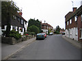
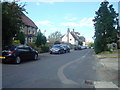
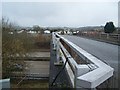
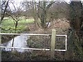
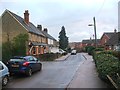
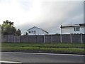
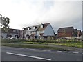
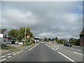
69 photos from this area
Area Information
Key information about the ME17 1HX including its size, population, and administrative classification.
- Area Type
- Postcode
- Area Size
- 1.5 hectares
- Population
- 1876
- Population Density
- 429 people/km²
House Prices in ME17 1HX
43
Properties
£248,500
Average Sold Price
£85,000
Lowest Price
£475,000
Highest Price
Showing 43 properties
| Address | Type | Beds | Baths | Last Sale Price | Last Sale Date | |
|---|---|---|---|---|---|---|
| 63 West Street, Harrietsham, ME17 1HX | Terraced | 4 | 1 | £320,000 | Feb 2025 | |
| 57 West Street, Harrietsham, ME17 1HX | house | - | - | £207,000 | Jun 2022 | |
| 37 West Street, Harrietsham, ME17 1HX | house | - | - | £305,000 | Mar 2022 | |
| 49 West Street, Harrietsham, ME17 1HX | house | 3 | - | £322,500 | Feb 2022 | |
| 51 West Street, Harrietsham, ME17 1HX | Terraced | 3 | 1 | £222,000 | Sep 2020 | |
| The Roebuck Inn, West Street, Harrietsham, ME17 1HX | Leisure | - | - | £475,000 | Jan 2020 | |
| 47 West Street, Harrietsham, ME17 1HX | Semi-detached | 2 | 1 | £288,000 | Oct 2019 | |
| 39 West Street, Harrietsham, ME17 1HX | Semi-detached | 2 | 1 | £265,000 | Sep 2019 | |
| 59 West Street, Harrietsham, ME17 1HX | house | 2 | - | £185,000 | May 2019 | |
| 71 West Street, Harrietsham, ME17 1HX | Terraced | 2 | 1 | £289,000 | Jun 2018 |
Page 1 of 5
Energy Efficiency in ME17 1HX
Amenities
Schools
| Rank | School | Type | Entry gender | Ages |
|---|
Explore more schools in this area
Go to Schools tabDemographics
Household Size
Family (3-5 people)
most common
Accommodation Type
Houses
most common
Tenure
77
majority
Ethnic Group
White
most common
Religion
N/A
most common
Household Composition
N/A
most common
Age
47
median
Adults (30-64 years)
most common
Household Deprivation
N/A
with no deprivation
NS-SEC
40
in Lower managerial occupations
Explore more demographic insights in this area
Go to Demographics tabPlanning
Planning Constraints
- Flood RiskPremium
- Ramsar Wetland SitesPremium
- Area of Outstanding Natural BeautyPremium
- Protected Nature ReservePremium
- Protected WoodlandPremium