Area Overview for ME15 9FB
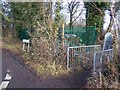
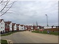
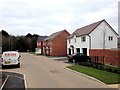
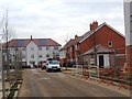
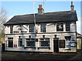
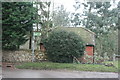
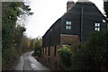
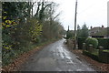
Photos of ME15 9FB


Area Information
Living in ME15 9FB means inhabiting a compact, densely populated residential cluster in England. The area spans 9,781 square metres, housing 1,612 people in a highly concentrated layout, with a population density of 164,801 people per square kilometre. This small postcode area is characterised by its proximity to essential services and transport links, making it practical for daily life. The community here is predominantly home-owning, with 76% of residents owning their properties, and most homes are traditional houses rather than flats. The median age is 22, but the most common age range is 30–64, suggesting a mix of younger and middle-aged residents. While the area lacks natural or protected landscapes, its strategic location near rail stations and retail hubs ensures accessibility. ME15 9FB is not a place for those seeking sprawling open spaces, but it offers convenience and connectivity for those prioritising proximity to amenities and commuting options.
- Area Type
- Postcode
- Area Size
- 9781 m²
- Population
- 1612
- Population Density
- 1765 people/km²
The property market in ME15 9FB is dominated by owner-occupied homes, with 76% of residents owning their properties. This suggests a stable market with limited rental activity, making it more attractive to buyers seeking long-term investment rather than short-term lets. The accommodation type is primarily houses, not flats, which is unusual for a small postcode area but may reflect the local housing stock’s design. Given the high population density and small area size, the housing stock is likely limited, with properties closely spaced. Buyers should consider the scarcity of available homes and the potential for competition. The area’s proximity to rail stations and retail amenities may enhance its appeal, though the compact size means the immediate surroundings are the primary focus for property searches. For those prioritising ownership over rental flexibility, ME15 9FB offers a concentrated, established market.
House Prices in ME15 9FB
Showing 1 properties
| Address | Type | Beds | Baths | Last Sale Price | Last Sale Date | |
|---|---|---|---|---|---|---|
| F G Barnes And Sons Ltd, Sutton Road, Maidstone, ME15 9FB | retail_financial | - | - | - | - |
Energy Efficiency in ME15 9FB
Daily life in ME15 9FB is shaped by its proximity to retail and rail services. Nearby shops include Aldi Langley, Morrisons Daily, and Co-op Maidstone, providing essential groceries and household items. These stores are within walking or short driving distance, enhancing convenience for residents. The area’s rail network, with stations at Bearsted, Maidstone West, and Maidstone East, connects residents to wider regional hubs, supporting both local and long-distance travel. While the data does not mention parks or leisure facilities, the compact layout suggests that amenities are tightly clustered, reducing travel time for errands or socialising. The combination of retail access and rail connectivity ensures a practical lifestyle, though those seeking expansive green spaces may need to look beyond the immediate area.
Amenities
Schools
The nearest school to ME15 9FB is Leigh Academy Langley Park, an academy with a Good Ofsted rating. This school serves the local community, offering a structured education for children in the area. As the only listed school nearby, it is the primary option for families. The presence of an academy suggests a focus on specialist or improved educational outcomes, though no other schools are documented in the data. Families relying on this single school may need to consider commuting options or future expansion plans. The Good rating indicates a satisfactory standard of education, but the lack of additional schools means limited choice for parents seeking alternatives. For those prioritising proximity to a reliable school, Leigh Academy Langley Park is the key facility in the area.
| Rank | School | Type | Entry gender | Ages |
|---|
Explore more schools in this area
Go to Schools tabDemographics
ME15 9FB’s population is young, with a median age of 22, though the most common age range is 30–64 years. This suggests a community of working-age adults, possibly including professionals or families with children. Home ownership is high, at 76%, indicating a stable, long-term resident base. The area is predominantly occupied by houses, not flats, which aligns with the high proportion of owner-occupied properties. The predominant ethnic group is White, though no specific diversity statistics are provided. The population density of 164,801 people per square kilometre is exceptionally high, implying tightly packed housing and limited open space. This density may affect living conditions, with homes likely close together. For buyers, this means a compact, possibly mature housing stock with limited new development, but also a community with established infrastructure and services nearby.
Household Size
Accommodation Type
Tenure
Ethnic Group
Religion
Household Composition
Age
Household Deprivation
NS-SEC
Explore more demographic insights in this area
Go to Demographics tabPlanning
Planning Constraints
- Flood RiskPremium
- Ramsar Wetland SitesPremium
- Area of Outstanding Natural BeautyPremium
- Protected Nature ReservePremium
- Protected WoodlandPremium