Area Overview for ME15 8RJ
Photos of ME15 8RJ

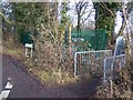
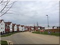
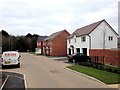
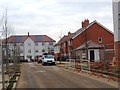

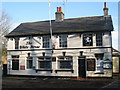
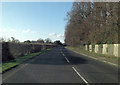

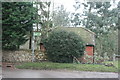
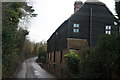
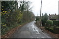
24 photos from this area
Area Information
Key information about the ME15 8RJ including its size, population, and administrative classification.
- Area Type
- Postcode
- Area Size
- 11.1 hectares
- Population
- 2049
- Population Density
- 580 people/km²
House Prices in ME15 8RJ
19
Properties
£473,462
Average Sold Price
£245,000
Lowest Price
£930,000
Highest Price
Showing 19 properties
| Address | Type | Beds | Baths | Last Sale Price | Last Sale Date | |
|---|---|---|---|---|---|---|
| White Horse Cottage, Honey Lane, Otham, ME15 8RJ | Detached | 4 | 2 | £930,000 | Sep 2024 | |
| April Cottage, Honey Lane, Otham, ME15 8RJ | Detached | 4 | 2 | £630,000 | Dec 2023 | |
| Mirabelle, Honey Lane, Otham, ME15 8RJ | Retail | 3 | 1 | £412,000 | Apr 2022 | |
| Drones End Cottage, Honey Lane, Otham, ME15 8RJ | Bungalow | - | - | £410,000 | Mar 2021 | |
| Longstop, Honey Lane, Otham, ME15 8RJ | Bungalow | 3 | 2 | £445,000 | Mar 2021 | |
| Birchwood House, Honey Lane, Otham, ME15 8RJ | house | - | - | £500,000 | Oct 2020 | |
| Maybury, Honey Lane, Otham, ME15 8RJ | house | - | - | £490,000 | Apr 2020 | |
| Farthings, Honey Lane, Otham, ME15 8RJ | Bungalow | - | - | £425,000 | Oct 2019 | |
| Greenlands, Honey Lane, Otham, ME15 8RJ | Bungalow | - | - | £390,000 | Oct 2017 | |
| Nydia, Honey Lane, Otham, ME15 8RJ | Bungalow | 3 | - | £366,000 | Aug 2015 |
Page 1 of 2
Energy Efficiency in ME15 8RJ
Amenities
Schools
| Rank | School | Type | Entry gender | Ages |
|---|
Explore more schools in this area
Go to Schools tabDemographics
Household Size
Family (3-5 people)
most common
Accommodation Type
Houses
most common
Tenure
77
majority
Ethnic Group
White
most common
Religion
N/A
most common
Household Composition
N/A
most common
Age
47
median
Adults (30-64 years)
most common
Household Deprivation
N/A
with no deprivation
NS-SEC
41
in Lower managerial occupations
Explore more demographic insights in this area
Go to Demographics tabPlanning
Planning Constraints
- Flood RiskPremium
- Ramsar Wetland SitesPremium
- Area of Outstanding Natural BeautyPremium
- Protected Nature ReservePremium
- Protected WoodlandPremium