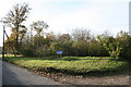
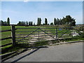
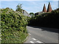
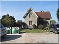
Area Overview for ME15 0PW
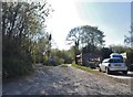
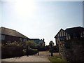
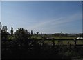
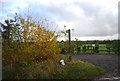
Photos of ME15 0PW


Area Information
ME15 0PW is a compact residential area in England, covering just 3.5 hectares and home to 1,358 residents. Its small size means it feels intimate, with a population density of 461 people per square kilometre. This postcode cluster is characterised by a focus on homeownership, with 88% of properties owned by residents rather than rented. The area’s demographic profile suggests a mature community, with a median age of 47 and most residents falling into the 30-64 age bracket. Daily life here is likely to revolve around local amenities, with nearby shops and transport links providing convenience. The presence of East Farleigh Primary School, rated ‘good’ by Ofsted, adds to the appeal for families. While the area is small, its proximity to rail stations and retail hubs like Tesco and Lidl ensures practical access to services. For those considering living in ME15 0PW, the balance of residential tranquillity and accessible infrastructure makes it a viable option for those prioritising community and convenience.
- Area Type
- Postcode
- Area Size
- 3.5 hectares
- Population
- 1358
- Population Density
- 461 people/km²
ME15 0PW is primarily an owner-occupied area, with 88% of properties owned by residents. This high rate of homeownership suggests a stable market with limited rental activity, making it more attractive to buyers seeking long-term investment. The accommodation type is predominantly houses, which aligns with the area’s small size and residential character. Given the compact nature of the postcode, the housing stock is likely limited to individual properties rather than larger developments. For buyers, this means competition may be lower, but the pool of available homes is also constrained. The focus on houses may appeal to those prioritising space and privacy, though the area’s size means proximity to amenities is key. Buyers should consider the immediate surroundings, as the small postcode may not offer a wide range of property options. The high home ownership rate also indicates that properties here are likely to be well-maintained, reflecting the community’s investment in their homes.
House Prices in ME15 0PW
Showing 1 properties
| Address | Type | Beds | Baths | Last Sale Price | Last Sale Date | |
|---|---|---|---|---|---|---|
| Castacrete Ltd, Stone House, Dean Street, East Farleigh, ME15 0PW | Industrial | - | - | - | - |
Energy Efficiency in ME15 0PW
Living in ME15 0PW offers access to essential amenities within a short reach. Retail options include major chains like Tesco and Lidl, providing convenience for grocery shopping. The presence of five rail stations, such as East Farleigh and Maidstone West, ensures easy access to public transport, facilitating travel to nearby towns for work, shopping, or leisure. While the data does not specify parks or recreational spaces, the area’s small size suggests a focus on residential comfort rather than expansive green spaces. The compact nature of the postcode means amenities are tightly clustered, reducing the need for long commutes. For those prioritising convenience, the combination of retail and rail connectivity makes daily life efficient. However, the absence of detailed information on leisure or cultural facilities means residents may need to venture further afield for activities beyond shopping and transport. Overall, the lifestyle in ME15 0PW balances practicality with a residential setting that prioritises accessibility.
Amenities
Schools
The nearest school to ME15 0PW is East Farleigh Primary School, which serves the local community with a ‘good’ Ofsted rating. This school is the only one listed in the data, suggesting that primary education is readily accessible for families in the area. The absence of secondary schools or other educational institutions within the postcode means parents may need to look slightly beyond ME15 0PW for secondary education. However, the presence of a well-rated primary school is a significant advantage for families with young children, offering a stable foundation for early education. The school’s rating indicates it meets acceptable standards in teaching and student outcomes, though further details on its curriculum or facilities are not provided. For those prioritising schools, the proximity of East Farleigh Primary School is a key consideration, though secondary education options would require a broader search.
| Rank | School | Type | Entry gender | Ages |
|---|
Explore more schools in this area
Go to Schools tabDemographics
The population of ME15 0PW is 1,358, with a median age of 47, indicating a predominantly adult population. Most residents are aged between 30 and 64, reflecting a mature community. Home ownership is high at 88%, suggesting a stable, long-term resident base. The area is composed mainly of houses, with no mention of flats or other accommodation types. The predominant ethnic group is White, though specific data on diversity is not provided. The population density of 461 people per square kilometre implies a mix of single-family homes and possibly some multi-generational households. This density, while not excessively high, means residents are likely to know their neighbours, fostering a sense of community. The age profile suggests a focus on family life, with many residents potentially raising children in the area. The absence of detailed deprivation data means quality of life factors like access to services and employment opportunities are not explicitly quantified, but the presence of schools and amenities suggests a reasonable standard of living.
Household Size
Accommodation Type
Tenure
Ethnic Group
Religion
Household Composition
Age
Household Deprivation
NS-SEC
Explore more demographic insights in this area
Go to Demographics tabPlanning
Planning Constraints
- Flood RiskPremium
- Ramsar Wetland SitesPremium
- Area of Outstanding Natural BeautyPremium
- Protected Nature ReservePremium
- Protected WoodlandPremium