Area Overview for ME15 0LX
Photos of ME15 0LX
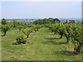

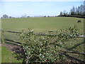
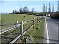
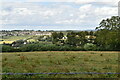
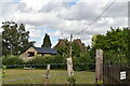
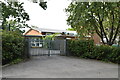
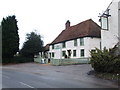
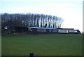

39 photos from this area
Area Information
Key information about the ME15 0LX including its size, population, and administrative classification.
- Area Type
- Postcode
- Area Size
- 35.4 hectares
- Population
- 1358
- Population Density
- 461 people/km²
House Prices in ME15 0LX
23
Properties
£745,385
Average Sold Price
£385,000
Lowest Price
£1,435,000
Highest Price
Showing 23 properties
| Address | Type | Beds | Baths | Last Sale Price | Last Sale Date | |
|---|---|---|---|---|---|---|
| Meadowside, Vicarage Lane, East Farleigh, ME15 0LX | Detached | 4 | 2 | £710,000 | Oct 2025 | |
| Larchmont, Vicarage Lane, East Farleigh, ME15 0LX | Detached | 5 | 2 | £760,000 | Apr 2024 | |
| Rathlyn, Vicarage Lane, East Farleigh, ME15 0LX | house | - | - | £480,000 | Dec 2021 | |
| Cedarwood House, Vicarage Lane, East Farleigh, ME15 0LX | Semi-detached | - | - | £1,435,000 | Jun 2021 | |
| Willow Wood, Vicarage Lane, East Farleigh, ME15 0LX | Farm | 6 | 3 | £1,150,000 | Aug 2020 | |
| Mistral, Vicarage Lane, East Farleigh, ME15 0LX | house | - | - | £565,000 | Aug 2020 | |
| The Old Vicarage, Vicarage Lane, East Farleigh, ME15 0LX | house | - | - | £1,135,000 | Mar 2017 | |
| Kasten, Vicarage Lane, East Farleigh, ME15 0LX | Detached | 5 | 4 | £880,000 | Dec 2015 | |
| Quartettes, Vicarage Lane, East Farleigh, ME15 0LX | Detached | 4 | 3 | £775,000 | Nov 2015 | |
| Gerrans, Vicarage Lane, East Farleigh, ME15 0LX | Bungalow | 4 | 1 | £385,000 | May 2013 |
Page 1 of 3
Energy Efficiency in ME15 0LX
Amenities
Schools
| Rank | School | Type | Entry gender | Ages |
|---|
Explore more schools in this area
Go to Schools tabDemographics
Household Size
Family (3-5 people)
most common
Accommodation Type
Houses
most common
Tenure
88
majority
Ethnic Group
White
most common
Religion
N/A
most common
Household Composition
N/A
most common
Age
47
median
Adults (30-64 years)
most common
Household Deprivation
N/A
with no deprivation
NS-SEC
41
in Lower managerial occupations
Explore more demographic insights in this area
Go to Demographics tabPlanning
Planning Constraints
- Flood RiskPremium
- Ramsar Wetland SitesPremium
- Area of Outstanding Natural BeautyPremium
- Protected Nature ReservePremium
- Protected WoodlandPremium