Area Overview for ME14 4NE
Photos of ME14 4NE
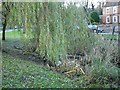
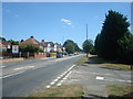
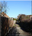
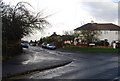
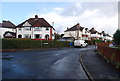
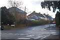
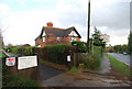
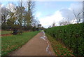
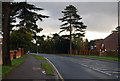
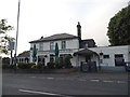
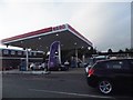
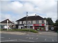
73 photos from this area
Area Information
Key information about the ME14 4NE including its size, population, and administrative classification.
- Area Type
- Postcode
- Area Size
- 7.6 hectares
- Population
- 1555
- Population Density
- 1811 people/km²
House Prices in ME14 4NE
32
Properties
£582,654
Average Sold Price
£116,500
Lowest Price
£900,000
Highest Price
Showing 32 properties
| Address | Type | Beds | Baths | Last Sale Price | Last Sale Date | |
|---|---|---|---|---|---|---|
| 181 Ashford Road, Bearsted, ME14 4NE | Detached | 1 | 1 | £870,000 | May 2023 | |
| 155 Ashford Road, Bearsted, ME14 4NE | house | - | - | £900,000 | Oct 2022 | |
| 147 Ashford Road, Bearsted, ME14 4NE | Detached | 4 | 2 | £740,000 | Jun 2021 | |
| 177 Ashford Road, Bearsted, ME14 4NE | Detached | 4 | 2 | £650,000 | Jun 2021 | |
| 169 Ashford Road, Bearsted, ME14 4NE | Bungalow | 4 | 2 | £720,000 | Dec 2018 | |
| 179 Ashford Road, Bearsted, ME14 4NE | Detached | 4 | 2 | £580,000 | Mar 2018 | |
| 167A Ashford Road, Bearsted, ME14 4NE | house | - | - | £350,000 | Dec 2015 | |
| 183 Ashford Road, Bearsted, ME14 4NE | Bungalow | 4 | - | £515,000 | Jul 2015 | |
| 185 Ashford Road, Bearsted, ME14 4NE | house | - | - | £865,000 | Mar 2014 | |
| 173 Ashford Road, Bearsted, ME14 4NE | house | 5 | - | £768,000 | Jan 2012 |
Page 1 of 4
Energy Efficiency in ME14 4NE
Amenities
Schools
| Rank | School | Type | Entry gender | Ages |
|---|
Explore more schools in this area
Go to Schools tabDemographics
Household Size
Two person
most common
Accommodation Type
Houses
most common
Tenure
90
majority
Ethnic Group
White
most common
Religion
N/A
most common
Household Composition
N/A
most common
Age
47
median
Adults (30-64 years)
most common
Household Deprivation
N/A
with no deprivation
NS-SEC
45
in Lower managerial occupations
Explore more demographic insights in this area
Go to Demographics tabPlanning
Planning Constraints
- Flood RiskPremium
- Ramsar Wetland SitesPremium
- Area of Outstanding Natural BeautyPremium
- Protected Nature ReservePremium
- Protected WoodlandPremium