Area Overview for ME14 4NA
Photos of ME14 4NA

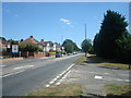

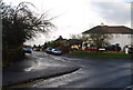
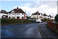
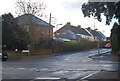
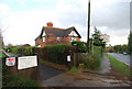

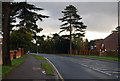
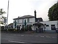

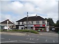
73 photos from this area
Area Information
Key information about the ME14 4NA including its size, population, and administrative classification.
- Area Type
- Postcode
- Area Size
- 1.1 hectares
- Population
- 1555
- Population Density
- 1811 people/km²
House Prices in ME14 4NA
9
Properties
£451,000
Average Sold Price
£150,000
Lowest Price
£579,000
Highest Price
Showing 9 properties
| Address | Type | Beds | Baths | Last Sale Price | Last Sale Date | |
|---|---|---|---|---|---|---|
| 142 Ashford Road, Bearsted, ME14 4NA | Bungalow | - | - | £579,000 | Jul 2020 | |
| 148 Ashford Road, Bearsted, ME14 4NA | house | - | - | £505,000 | Feb 2019 | |
| 144 Ashford Road, Bearsted, ME14 4NA | Bungalow | 5 | 3 | £570,000 | Jul 2018 | |
| 146 Ashford Road, Bearsted, ME14 4NA | Bungalow | 3 | 2 | £150,000 | May 2001 | |
| Flat, 140-A-140-B Ashford Road, Bearsted, ME14 4NA | Flat | - | - | - | - | |
| 140 Ashford Road, Bearsted, ME14 4NA | Semi-detached | - | - | - | - | |
| 150 Ashford Road, Bearsted, ME14 4NA | Detached | - | - | - | - | |
| 152 Ashford Road, Bearsted, ME14 4NA | Bungalow | - | - | - | - | |
| Photo-me International, Self Service Laundrette, Yeoman Service Station, 134 Ashford Road, Bearsted, ME14 4NA | Retail | - | - | - | - |
Energy Efficiency in ME14 4NA
Amenities
Schools
| Rank | School | Type | Entry gender | Ages |
|---|
Explore more schools in this area
Go to Schools tabDemographics
Household Size
Two person
most common
Accommodation Type
Houses
most common
Tenure
90
majority
Ethnic Group
White
most common
Religion
N/A
most common
Household Composition
N/A
most common
Age
47
median
Adults (30-64 years)
most common
Household Deprivation
N/A
with no deprivation
NS-SEC
45
in Lower managerial occupations
Explore more demographic insights in this area
Go to Demographics tabPlanning
Planning Constraints
- Flood RiskPremium
- Ramsar Wetland SitesPremium
- Area of Outstanding Natural BeautyPremium
- Protected Nature ReservePremium
- Protected WoodlandPremium