Area Overview for ME11 5BE
Photos of ME11 5BE

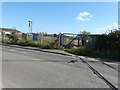
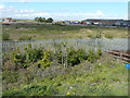
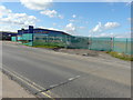
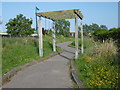
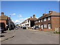
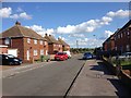
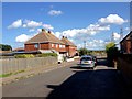
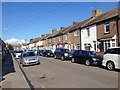
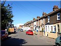
46 photos from this area
Area Information
Key information about the ME11 5BE including its size, population, and administrative classification.
- Area Type
- Postcode
- Area Size
- 1.0 hectares
- Population
- 1694
- Population Density
- 617 people/km²
House Prices in ME11 5BE
59
Properties
£117,984
Average Sold Price
£25,000
Lowest Price
£228,000
Highest Price
Showing 59 properties
| Address | Type | Beds | Baths | Last Sale Price | Last Sale Date | |
|---|---|---|---|---|---|---|
| 15 Harold Street, Queenborough, ME11 5BE | Terraced | 2 | 1 | £188,500 | Apr 2025 | |
| 36 Harold Street, Queenborough, ME11 5BE | house | 2 | - | £170,000 | Oct 2024 | |
| 24 Harold Street, Queenborough, ME11 5BE | Terraced | 2 | 1 | £160,000 | Nov 2023 | |
| 16 Harold Street, Queenborough, ME11 5BE | Terraced | 2 | 2 | £222,500 | Jul 2023 | |
| 29 Harold Street, Queenborough, ME11 5BE | house | 2 | 1 | £228,000 | Feb 2023 | |
| 10 Harold Street, Queenborough, ME11 5BE | Terraced | 2 | 1 | £150,000 | Mar 2022 | |
| 6 Harold Street, Queenborough, ME11 5BE | Terraced | 2 | - | £210,000 | Oct 2021 | |
| 43 Harold Street, Queenborough, ME11 5BE | Terraced | 2 | 1 | £175,000 | May 2021 | |
| 58 Harold Street, Queenborough, ME11 5BE | house | - | - | £162,000 | Mar 2021 | |
| 26 Harold Street, Queenborough, ME11 5BE | house | - | - | £150,000 | Nov 2020 |
Page 1 of 6
Energy Efficiency in ME11 5BE
Amenities
Schools
| Rank | School | Type | Entry gender | Ages |
|---|
Explore more schools in this area
Go to Schools tabDemographics
Household Size
Family (3-5 people)
most common
Accommodation Type
Houses
most common
Tenure
61
majority
Ethnic Group
White
most common
Religion
N/A
most common
Household Composition
N/A
most common
Age
47
median
Adults (30-64 years)
most common
Household Deprivation
N/A
with no deprivation
NS-SEC
19
in Lower managerial occupations
Explore more demographic insights in this area
Go to Demographics tabPlanning
Planning Constraints
- Flood RiskPremium
- Ramsar Wetland SitesPremium
- Area of Outstanding Natural BeautyPremium
- Protected Nature ReservePremium
- Protected WoodlandPremium