Area Overview for ME11 5BG
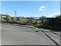
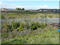
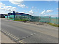
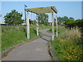
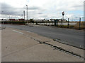
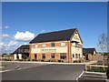
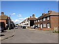
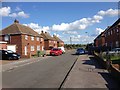
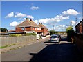
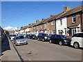
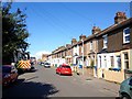
Photos of ME11 5BG

Area Information
ME11 5BG is a small residential postcode in England, home to 1,694 people spread across a compact area with a density of 617 people per square kilometre. This cluster of homes is defined by its proximity to Queenborough and surrounding towns, offering a quiet, semi-rural feel with easy access to nearby transport hubs. The area’s population skews towards adults aged 30–64, reflecting a mature community with established roots. Daily life here is shaped by its location: residents benefit from nearby rail stations, including Queenborough and Swale, which connect to larger urban centres. The low flood risk and absence of protected natural sites suggest a stable, low-constraint environment for living. However, the area’s crime risk is above average, with a safety score of 14/100, indicating a need for vigilance. Despite this, ME11 5BG’s blend of practical amenities, such as local shops and transport links, makes it a viable option for those seeking a balanced lifestyle in a manageable, small-scale community.
- Area Type
- Postcode
- Area Size
- Not available
- Population
- 1694
- Population Density
- 617 people/km²
ME11 5BG is primarily an owner-occupied area, with 61% of homes owned by residents rather than rented. The accommodation type is predominantly houses, which contrasts with areas dominated by flats or apartments. This suggests a market skewed towards family homes or single-family dwellings, appealing to those prioritising space and privacy. Given the area’s small size, the housing stock is limited, making it a niche market for buyers seeking properties in a low-density setting. The presence of nearby rail stations, such as Queenborough and Swale, may enhance the area’s appeal for commuters, though the lack of larger urban amenities could limit its attractiveness to younger or more transient buyers. For those considering ME11 5BG, the focus on owner-occupation and traditional housing types means the market is likely to cater to long-term residents rather than investors.
House Prices in ME11 5BG
No properties found in this postcode.
Energy Efficiency in ME11 5BG
Living in ME11 5BG offers access to essential retail and transport hubs within easy reach. Local shops such as Co-op Queensborough, Iceland Queenborough, and Budgens Queenborough provide daily necessities, reducing the need for long trips to larger centres. The area’s rail network, including Queenborough and Swale stations, ensures convenient travel for commuting or leisure. While the data does not mention parks or leisure facilities, the proximity to rail and retail suggests a practical, no-frills lifestyle. The small-scale nature of the area means amenities are tightly clustered, fostering a sense of convenience for residents. For those prioritising proximity to services and transport, ME11 5BG delivers a straightforward, functional living experience.
Amenities
Schools
| Rank | School | Type | Entry gender | Ages |
|---|
Explore more schools in this area
Go to Schools tabDemographics
The population of ME11 5BG has a median age of 47, with the majority of residents falling within the 30–64 age range. This suggests a community of established adults, many of whom may be in their prime working years or nearing retirement. Home ownership is strong, with 61% of properties occupied by owners, indicating a stable housing market. The predominant accommodation type is houses, which aligns with the area’s character as a small, residential cluster. The predominant ethnic group is White, reflecting a homogenous demographic profile. While no specific data on deprivation is provided, the high home ownership rate and mature age profile suggest a relatively stable quality of life. However, the absence of detailed diversity metrics means the community’s broader social composition remains less defined.
Household Size
Accommodation Type
Tenure
Ethnic Group
Religion
Household Composition
Age
Household Deprivation
NS-SEC
Explore more demographic insights in this area
Go to Demographics tabPlanning
Planning Constraints
- Flood RiskPremium
- Ramsar Wetland SitesPremium
- Area of Outstanding Natural BeautyPremium
- Protected Nature ReservePremium
- Protected WoodlandPremium